Picnic Area (W, 26mi), Hawaii
Day Use Areas in Hawaii
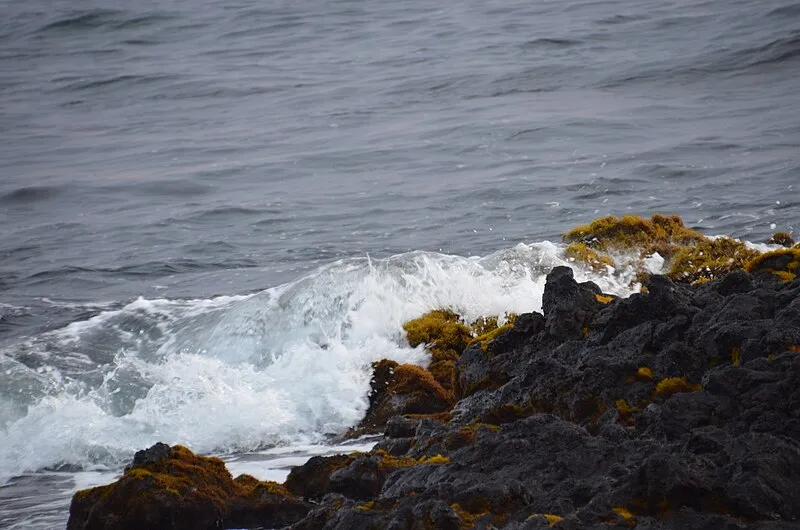
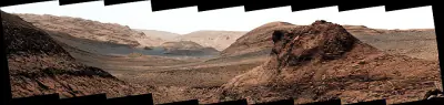
Photo: This file was created by Thomas Tunsch. It is not in the public domain and use of this file outside of the licensing terms is a copyright violation. Please credit authorship as follows: © CC BY-SA Thomas Tunsch / Kaloko-Honokōhau National Historical Park - panoramio (1).jpg (Wikimedia Commons). Source attribution by linking to this file page (//commons.wikimedia.org/wiki/File:Kaloko-Honok%C5%8Dhau_National_Historical_Park_-_panoramio_(1).jpg) is recommended. The application Lizenzhinweisgenerator can help to reuse pictures from Wikipedia and the free media file repository easily and legally. / CC BY-SA 4.0
Near Kailua Kona, HI in Hawaii
What to Pack for Picnic Area (W, 26mi), Hawaii
The right gear makes all the difference — here's a packing list tailored to this area.
Your packing list for Picnic Area should account for the Tropical terrain and variable conditions.
Essential
-
Water (minimum 2L) — Water sources marked on maps may be seasonal or dry; carrying enough to complete your route prevents a dangerous shortfall.
-
Navigation (map/GPS/compass) — Getting lost is the leading cause of backcountry search-and-rescue calls; reliable navigation prevents the situation entirely.
-
Sun protection (sunglasses, sunscreen) — Prolonged sun exposure causes headaches, fatigue, and heat exhaustion that can cut a trip short or create a medical emergency.
-
First aid kit — Remote locations mean longer response times for help; a first aid kit bridges the gap between injury and professional care.
-
Extra food — High-energy snacks weigh little but provide crucial fuel if you need to bushwhack out or wait for conditions to improve.
-
Headlamp with extra batteries — Hands-free light is essential for navigating uneven terrain, setting up camp, or signaling for help at night.
-
Fire starter — Waterproof matches or a ferro rod weigh almost nothing and can be the difference between a cold night and a survivable one.
-
Emergency shelter (space blanket) — Wind and rain strip heat faster than most people realize; a compact emergency shelter blocks both.
-
Knife or multi-tool — A multi-tool handles problems you can't predict: jammed zippers, tangled line, first-aid tape cutting, or gear fixes on the trail.
-
Extra clothing layer — A lightweight fleece or puffy stuffs small but provides critical insulation if temperatures drop unexpectedly.
Activities & Best Time to Visit Picnic Area (W, 26mi), Hawaii
The Tropical terrain here lends itself to a range of outdoor activities throughout the year.
Visitors come to Picnic Area primarily for photography, though the Tropical terrain opens up other options too.
With a photography score of 35/100, Picnic Area offers Exceptional dark sky (Bortle 1-2) and 1 excellent meteor showers worth capturing.
Activities
-
photography — Golden hour and dramatic weather can transform ordinary scenes into striking images.
-
picnicking — Picnicking turns a scenic overlook or shady grove into a memorable gathering spot.
-
walking — Walking lets you slow down and notice details — wildflowers, birdsong, shifting light through trees.
-
wildlife_viewing — Early mornings and dusk offer the best chances to quietly spot native wildlife.
Best months: Jan, Feb, Mar, Apr, May, Jun, Jul, Aug, Sep, Oct, Nov, Dec
Terrain: Tropical — Dense plant growth and broadleaf species dominate many tropical areas.
Nature & Wildlife at Picnic Area (W, 26mi), Hawaii
The Tropical terrain here supports a rich ecosystem worth noticing as you explore.
The forests and meadows around Picnic Area support a diverse community of wildlife, from Small Indian Mongoose and Domestic Goat to Red Avadavat and Wild Turkey.
Trees (3)
-
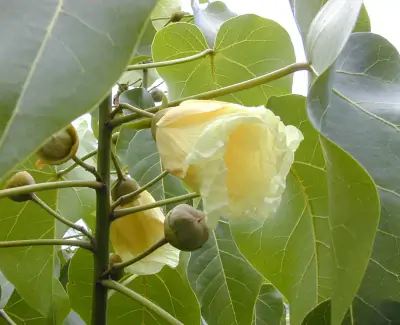 Portia tree — Portia tree is a coastal species with heart-shaped glossy leaves.
 -
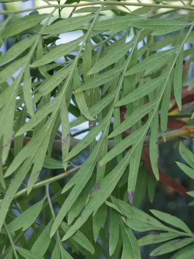 silk oak — Silk oak is an ornamental tree with fern-like divided leaves.
 -
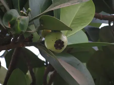 autograph tree — Autograph tree is an evergreen with thick leathery leaves.
Shrubs (1)
-
 tree heliotrope — Tree heliotrope is a woody shrub with large velvety leaves.
Other Plants (5)
-
kiawe
-
beach naupaka
-
Beach Morning Glory
-
yellow ʻilima
-
Fountain Grass
Mammals (4)
-
 Small Indian Mongoose — Short legs and coarse fur.
 -
 Domestic Goat — Coat color and length vary widely.
 -
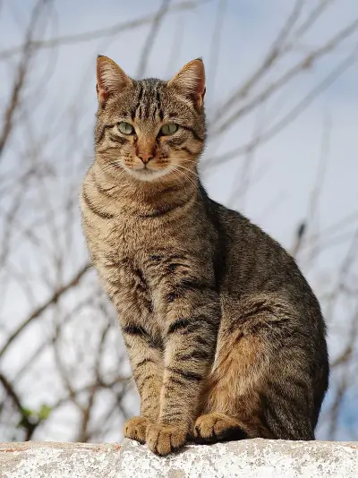 Domestic Cat — Retractable claws and sharp teeth adapted for hunting.
 -
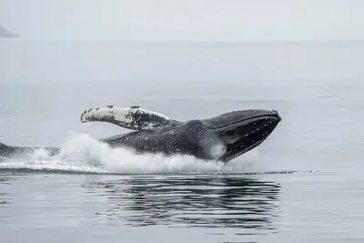 Humpback Whale — Dark body with white underside markings unique to each individual.
Birds (30)
-
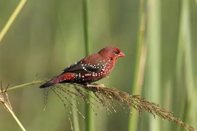 Red Avadavat — Brown female
 -
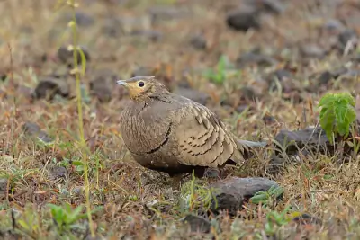
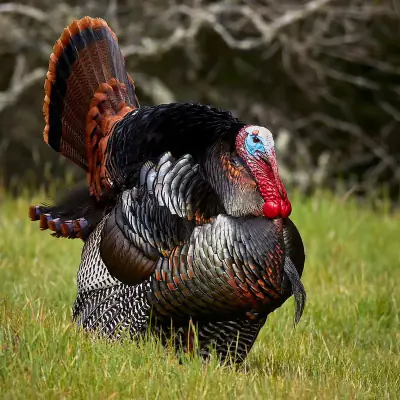 Wild Turkey — Male with fan-shaped tail and red wattle
 -
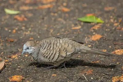 Zebra Dove — Blue eye ring
 -
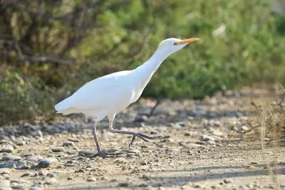 Western Cattle-Egret — Buff-orange plumes in breeding
 -
 Chestnut-bellied Sandgrouse — Chestnut belly in male
Reptiles (6)
-
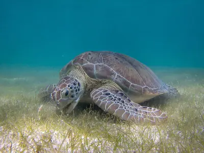 Green Sea Turtle — Head is relatively small compared to body size.
 -
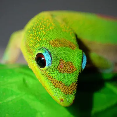 Gold Dust Day Gecko — Red markings may appear on snout and head.
 -
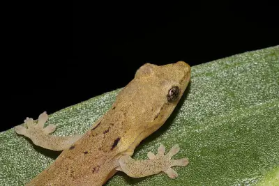 Mourning Gecko — Large eyes and adhesive toe pads are prominent.
 -
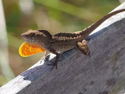 Brown Anole — Males display an orange-red throat fan.
 -
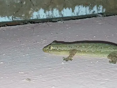 Asian House Gecko — Adhesive toe pads allow climbing smooth surfaces.
Amphibians (1)
-
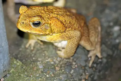 Cane Toad
Insects (5)
-
 Black Witch
 -
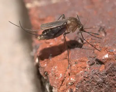 Southern House Mosquito
 -
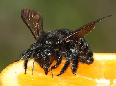 Valley Carpenter Bee
 -
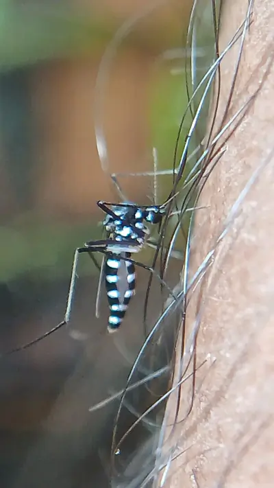 Asian Tiger Mosquito
 -
 Yellow Fever Mosquito
Other Wildlife (20)
-
Thin-shelled Rock Crab
-
Indo-Pacific Rock-boring Urchin
-
Hawaiian Convict Surgeonfish
-
Pacific White-spotted Sea Cucumber
-
Red Pencil Urchin
Nature Bingo at Picnic Area (W, 26mi), Hawaii
Can you spot them all? Check off each species as you find it on your visit.
Wildlife Challenge
Botany Challenge
Picnic Area (W, 26mi), Hawaii Trip Planning & Access
Ready to visit? Here's what to know about getting here and what it'll cost.
Getting to Picnic Area means a 2386-mile drive from San Jose, the closest major city.
Visitor Friendliness
Visitor friendliness: families (excellent), dogs (likely_allowed), elderly (highly_suitable).
- Dogs: likely_allowed — No restrictions found
- Families: excellent
- Elderly: highly_suitable
- Strollers: excellent (100/100)
- Beginners: Perfect for beginners (Easy difficulty - perfect for beginners (+20))
- Accessibility: Generally accessible to most visitors (100/100)
Places Near Picnic Area (W, 26mi), Hawaii
If you're in the area, these nearby destinations are worth considering too.
The area around Picnic Area includes trails, campgrounds, and other destinations.
Nearby Trails
Nearby Attractions
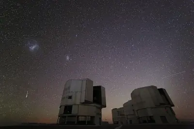
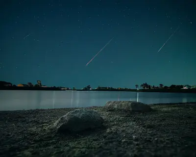
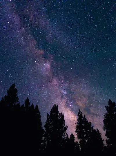
Stargazing & Night Sky at Picnic Area (W, 26mi), Hawaii
If you're staying past sunset, the stargazing conditions here are worth planning around.
With Bortle class 1 skies, Picnic Area offers Excellent dark-sky site conditions for observing the night sky.
Meteor Showers
For meteor viewing, the Geminids (December 13-14) offers the best show at this location.
-
 Geminids — peaks December 13-14 (excellent)
Cold December air often means clear skies—look overhead after midnight for bright, slow-moving meteors.
-
 Quadrantids — peaks January 3-4 (good)
Bundle up—January nights are frigid, but dark skies can produce bright fireballs.
-
 Perseids — peaks August 11-13 (good)
Peak activity typically builds after midnight when Perseus climbs higher.
-
 Eta Aquariids — peaks May 5-6 (good)
Southern U.S. observers often get better rates due to the radiant's position.
-
 Delta Aquariids — peaks July 28-29 (good)
This steady shower rewards patient observers in dark, moonless conditions.
Planets
Planets visible to the naked eye from this location:
-
 Venus — The brightest planet, often called the Morning or Evening Star
 -
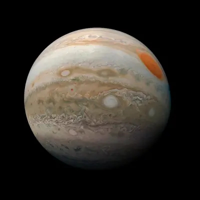 Jupiter — The largest planet, bright and steady in the night sky
 -
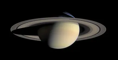 Saturn — Famous for its rings, visible as a golden steady light
 -
 Mars — The Red Planet, recognizable by its reddish-orange hue
Equipment Guide
- Naked eye: Venus, Jupiter, Saturn, Mars, Mercury (with care)
- Binoculars: Jupiter moons, Uranus, Saturn rings (barely)
- Small telescope: Saturn rings, Jupiter bands, Mars surface features, Neptune
Viewing Tips
- Check planets rise/set times for your specific date
- Planets appear along the ecliptic (zodiac path)
- Planets don't twinkle like stars - steady light
- Venus and Jupiter are unmistakable - brightest objects after Moon
- Use a stargazing app to confirm planet positions
- Best viewing: when planet is highest in sky (transit)
Best Viewing Months
- Evening: Oct, Nov, Dec, Jan, Feb
- Morning: Jul, Aug, Sep
Seasonal Highlights at Picnic Area (W, 26mi), Hawaii
Each season brings something different to this area.
What you'll see at Picnic Area depends heavily on when you visit.
Indigenous Land at Picnic Area (W, 26mi), Hawaii
Long before trails were marked and campgrounds built, this land was home to Indigenous peoples.
This area is part of the ancestral territory of Nā moku ʻehā.
Territories
Languages
2 Indigenous languages are associated with the peoples of this area: ʻŌlelo Hawaiʻi, Hoailona ʻŌlelo o Hawaiʻi (Hawai’i Sign Language).
Data from Native Land Digital
Picnic Area (W, 26mi), Hawaii Geology & Natural History
Beyond the trails and wildlife, Picnic Area sits within a landscape shaped by millions of years of geological processes. Here's what researchers and surveys have documented about this area.
Endangered Species
- Species at Risk
- 1780
- ESA Endangered
- 149
- ESA Threatened
- 2
- Conservation Score
- 100/100
Temperature Records
- Record High
- 102°F (1910-11-28)
- Record Low
- 40°F (1937-02-09)
Watershed
- Watershed
- Kawaihae Bay-Pacific Ocean
Picnic Area (W, 26mi), Hawaii Safety & Conditions
Conditions change fast outdoors — bookmark these official sources for your visit.
Real-time safety data for Picnic Area — weather, fire, flood, and road conditions.
Coordinates: 19.686482, -156.032735