Vermilion Cliffs Highway, Coconino
Parks in Arizona
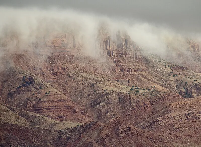
Photo: John Fowler from Placitas, NM, USA / CC BY 2.0
Near Fredonia, AZ in Arizona
What to Pack for Vermilion Cliffs Highway, Coconino
Given these conditions, here's what to pack for a safe and comfortable visit.
The right gear turns potential problems into non-issues. Here's what Vermilion Cliffs Highway demands.
Essential
-
Water (minimum 2L) — Dehydration impairs judgment and endurance long before you feel thirsty; 2L is the minimum for a moderate day hike.
-
Navigation (map/GPS/compass) — Phone batteries die, cell service disappears, and trail signs get vandalized; a paper map and compass always work.
-
Sun protection (sunglasses, sunscreen) — UV exposure intensifies at elevation and near reflective surfaces like water and snow; sunburn can happen in under 30 minutes.
-
First aid kit — Blisters, cuts, and sprains happen on even the easiest trails; basic supplies let you treat problems before they force a retreat.
-
Extra food — A wrong turn or unexpected storm can extend any outing by hours; extra calories prevent fatigue and poor decision-making.
-
Headlamp with extra batteries — Trails that seem short in daylight can take twice as long with route-finding or elevation; a headlamp keeps you moving safely after dark.
-
Fire starter — Hypothermia can set in even during summer at higher elevations; a reliable fire starter provides warmth and a signal for rescuers.
-
Emergency shelter (space blanket) — A space blanket weighs under two ounces and reflects up to 90% of body heat, buying time in an unplanned overnight.
-
Knife or multi-tool — From cutting cord to preparing food to improvising gear repairs, a knife is the most versatile tool you can carry.
-
Extra clothing layer — Mountain weather can shift from sunshine to sleet within an hour; an extra layer prevents dangerous heat loss.
Wildlife Gear
-
Bear canister — Storing food in a bear canister prevents bears from associating humans with food, which is the leading cause of dangerous bear behavior.
-
Bear spray — Studies show bear spray stops aggressive bear behavior in over 90% of encounters, outperforming firearms in field effectiveness.
-
Bear bell — Most bear encounters happen when hikers surprise a bear at close range; a bell provides continuous noise that alerts bears to your presence.
-
Hiking buddy (avoid solo) — Groups of three or more are almost never involved in serious bear incidents; larger groups make more noise and appear more intimidating.
-
Noise maker — Clapping, whistling, or using an air horn warns wildlife of your approach, preventing surprise encounters on blind corners.
-
Gaiters — Snake-proof gaiters provide a physical barrier against venomous bites below the knee, where most strikes occur.
-
First-aid snakebite kit — While evacuation to a hospital is the priority, a snakebite kit helps you stay calm and follow proper first-aid protocols.
Climate Gear
-
Layering system (wide temp swings) — Desert and mountain environments can swing 40+ degrees between dawn and midday; layers let you adapt without overheating or freezing.
Terrain Gear
-
Wide-brim hat — A wide brim shades your face, ears, and neck simultaneously, reducing UV exposure and lowering heat stroke risk.
-
Sunscreen SPF50+ — Reflected UV from water, sand, and snow can burn exposed skin even on overcast days; SPF50+ blocks 98% of UVB rays.
-
Extra water (desert) — Desert water sources are unreliable and often seasonal; carry all the water you need rather than counting on finding more.
-
SPF50 lip balm — Lips lack melanin and burn faster than other skin; cracked, sunburned lips at altitude are painful and slow to heal.
Seasonal Gear
- Spring: Camera, Wildflower field guide
- Fall: Camera, Binoculars (foliage viewing)
- Winter: Microspikes/traction devices
Activities & Best Time to Visit Vermilion Cliffs Highway, Coconino
The Desert terrain here lends itself to a range of outdoor activities throughout the year.
Vermilion Cliffs Highway draws visitors for hiking, but the 7 available activities mean there's more here than most expect.
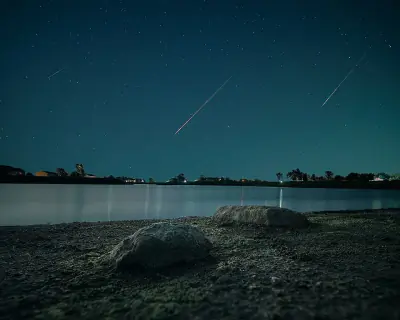
Photographers rate this area 65/100, with Exceptional dark sky (Bortle 1-2) and 3 excellent meteor showers being a major draw.
Activities
-
hiking — Follow marked trails through forests, deserts, or alpine terrain for a deeper connection with nature.
-
photography — Capture landscapes, wildlife, and changing light across trails, coastlines, and mountain vistas.
-
picnicking — Spread a blanket, unpack a meal, and enjoy food outdoors surrounded by fresh air and open views.
-
rv_camping — Travel with the comforts of home while staying in campgrounds or RV parks.
-
sightseeing — Take in scenic overlooks, landmarks, and natural features at a relaxed pace.
-
walking — A simple way to explore trails, shorelines, and park paths at your own pace while taking in the scenery.
-
wildlife_viewing — Observe animals in their natural habitats, from grazing deer to soaring raptors overhead.
Best months: May, Jun, Jul, Aug, Sep
Terrain: Desert — Desert terrain features sparse vegetation, exposed soils, and wide temperature swings between day and night.
Wildlife Safety at Vermilion Cliffs Highway, Coconino
While the wildlife here is part of the experience, some species require caution and preparation.
Awareness is the best safety tool at Vermilion Cliffs Highway. Here are the wildlife considerations for this area.
- Bears present
- Mountain lions
- Venomous snakes
- Remote (176mi from city)
- Exceptional dark sky (Bortle 1-2)
- 3 excellent meteor showers
- Fall foliage
- Spring wildflowers
Bears
This is Black Bear country. Encounters are uncommon but possible, especially during .
A stocky bear with rounded ears, a straight facial profile, and short curved claws built for climbing.
Store all food and scented items in bear-resistant containers and keep a clean campsite.
- Store food properly - use bear boxes or hang food bags
- Keep a clean camp - no food scraps
- Make noise while hiking
- Never approach cubs - mother is nearby
- Back away slowly if you encounter a bear
Venomous Snakes
Venomous snakes here include . They're most active during warm months.
- Watch where you step and place hands
- Stay on trails
- Wear boots and long pants in snake country
- Do not reach under rocks or logs
- If bitten: stay calm, immobilize limb, seek medical help immediately
- Do NOT: cut wound, suck venom, apply tourniquet, ice, or alcohol
Nature & Wildlife at Vermilion Cliffs Highway, Coconino
The Desert terrain here supports a rich ecosystem worth noticing as you explore.
10 bird species have been documented near Vermilion Cliffs Highway, alongside 5 mammals and a rich variety of native plants.
Trees (2)
-
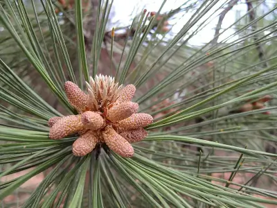 Southwestern Ponderosa Pine — Its thick bark forms broad orange plates separated by dark fissures.
 -
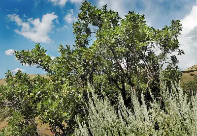 Gambel Oak — It often grows in dense thickets, spreading by underground sprouts to form large colonies.
Wildflowers (1)
-
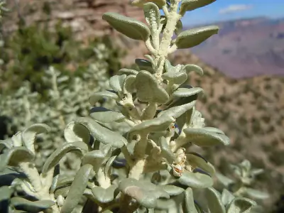
 Stansbury's Cliffrose — Evergreen shrub with finely divided gray-green leaves.
Shrubs (2)
-
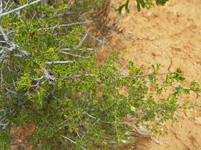
 Roundleaf buffaloberry — A thorny shrub with silvery round leaves and small yellow flowers.
 -
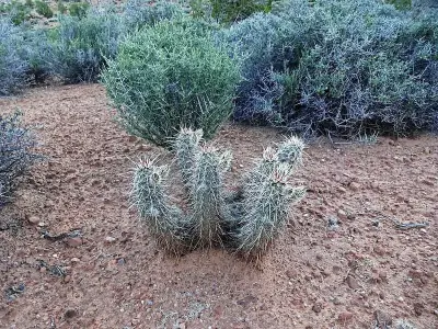 Engelmann's Hedgehog Cactus — Ribbed stems grow close to the ground and may form tight clusters over time. Spines range from straw-colored to reddish brown, offering protection from herbivores.
Other Plants (5)
-
Whipple Cholla
-
Spinystar
-
Kingcup Cactus
-
Utah Juniper
-
Plains Pricklypear
Mammals (5)
-
 Abert's Squirrel — A gray tree squirrel with distinctive long ear tufts in winter.
 -
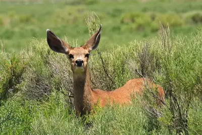 Mule Deer — A large deer with oversized mule-like ears and a black-tipped tail.
 -
 Common Golden-mantled Ground Squirrel — Chipmunk-like rodent with golden shoulders and white eye ring.
 -
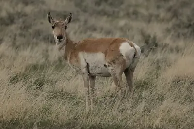 Pronghorn — A slender tan-and-white ungulate with distinctive black facial markings.
 -
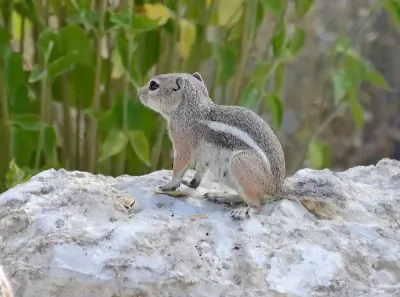 White-tailed Antelope Squirrel — A small desert squirrel with tan fur and white stripe along sides.
Birds (10)
-
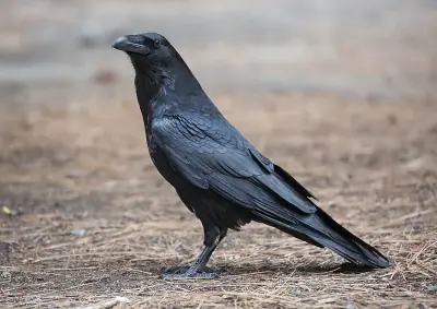 Common Raven — Large all-black bird with shaggy throat
 -
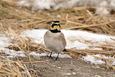 Horned Lark — Pale brown with black facial mask
 -
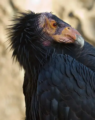 California Condor — Large black body
 -
 Bald Eagle — Adult with white head and tail
 -
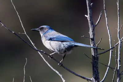 Woodhouse's Scrub-Jay — Blue head and wings
Reptiles (9)
-
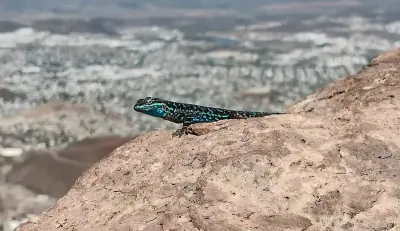
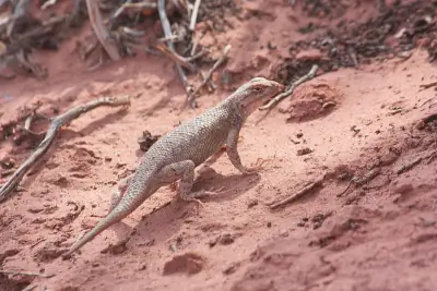 Desert Spiny Lizard — A robust lizard with rough spiny scales and gray to brown coloration.
 -
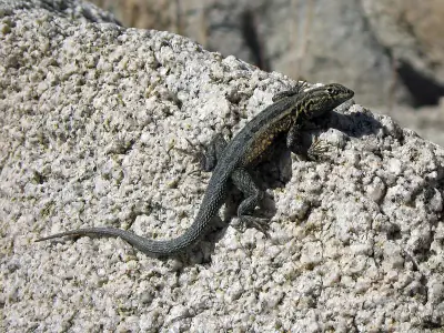 Common Side-blotched Lizard — A small slender lizard with mottled brown or gray coloration.
 -
 Greater Short-horned Lizard — A stout-bodied lizard with short horns on the back of the head.
 -
 Ornate Tree Lizard — A small spiny lizard with gray to brown coloration and subtle patterning.
 -
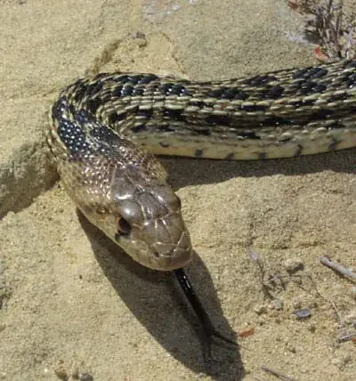 Gopher Snake — A large tan or yellowish snake with dark brown blotches along the back.
Insects (7)
-
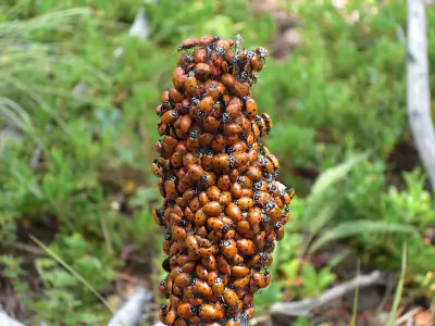 Convergent Lady Beetle
 -
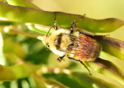 Hunt's Bumble Bee
 -
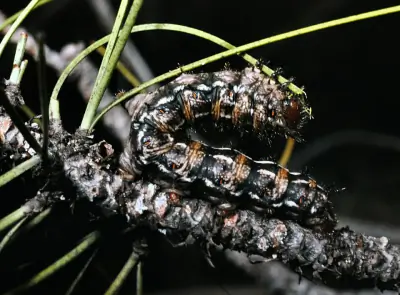 Pandora Pinemoth
 -
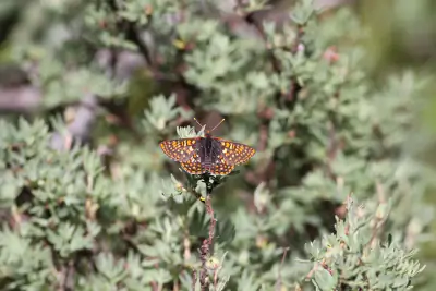 Anicia Checkerspot
 -
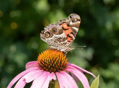 Painted Lady
Nature Bingo at Vermilion Cliffs Highway, Coconino
Can you spot them all? Check off each species as you find it on your visit.
Wildlife Challenge
Botany Challenge
Vermilion Cliffs Highway, Coconino Climate & Sun
For detailed planning, here's the climate data for this area.
The weather at Vermilion Cliffs Highway follows a Arid pattern — here's the monthly breakdown.
Climate type: Arid
Annual avg temp: 54.9°F
Annual precipitation: 10 in
With an average annual temperature of 54.9°F and 10 inches of precipitation, Vermilion Cliffs Highway has mild, dry conditions. Summer highs average around 78°F, while winter lows drop to 34°F.
Best months to visit: Apr, May, Jun, Sep, Oct.
| Month | Avg Temp | Precip |
|---|---|---|
| Jan | 34°F | 1.0 in |
| Feb | 39°F | 1.1 in |
| Mar | 46°F | 0.9 in |
| Apr | 52°F | 0.5 in |
| May | 61°F | 0.5 in |
| Jun | 72°F | 0.3 in |
| Jul | 78°F | 0.8 in |
| Aug | 75°F | 1.2 in |
| Sep | 68°F | 1.1 in |
| Oct | 56°F | 1.1 in |
| Nov | 44°F | 0.7 in |
| Dec | 34°F | 0.8 in |
Daylight & Sun Times
Daylight ranges from 9.7 hours in winter to 14.7 hours in summer — a difference of 5 hours.
Summer: 5:08 AM – 7:47 PM
Winter: 7:33 AM – 5:13 PM
Vermilion Cliffs Highway, Coconino Trip Planning & Access
Planning your trip to Vermilion Cliffs Highway — here's the practical information you'll need.
From Las Vegas, Vermilion Cliffs Highway is a drive covering 176 miles.
Visitor Friendliness
This location rates likely_allowed for dogs, excellent for families, and highly_suitable for elderly visitors.
- Dogs: likely_allowed — No restrictions found
- Families: excellent
- Elderly: highly_suitable
- Strollers: excellent (100/100)
- Beginners: Perfect for beginners (Moderate difficulty (+5), Good information available (+5))
- Accessibility: Generally accessible to most visitors (90/100)
Places Near Vermilion Cliffs Highway, Coconino
There's more to explore in this part of Arizona.
Here's what else is nearby if you want to expand your itinerary beyond Vermilion Cliffs Highway.
Nearby Trails
- Navajo Trail, Coconino 8.57 mi
- Ceballos Trail, Coconino 8.99 mi
- Kai-vav-wi Nature Trail, Coconino 9.42 mi
- North Timp Snowmobile Trail, Coconino 9.55 mi
- Arizona Trail (NW, 73mi), Coconino 13.75 mi
Nearby Campgrounds
Nearby Attractions
Stargazing & Night Sky at Vermilion Cliffs Highway, Coconino
Once you're geared up and settled in, the night sky here offers its own rewards.
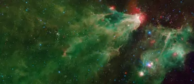
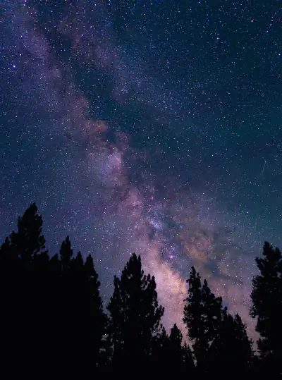
Vermilion Cliffs Highway sits under Bortle class 1 skies — Excellent dark-sky site for stargazing in Arizona.
Constellations
From Vermilion Cliffs Highway, you can trace Ursa Minor, Cassiopeia, Cepheus across the sky on clear nights.
-
 Ursa Minor — Home to Polaris, the North Star, Ursa Minor forms a small dipper shape that circles the northern sky year-round.
 -
 Cassiopeia — Easily recognized by its bright W-shaped pattern, Cassiopeia stands out in northern skies.
 -
 Cepheus — Cepheus appears as a faint house-shaped pattern near Polaris in the northern sky.
Meteor Showers
Time your visit around December 13-14 for the Geminids, the strongest meteor shower visible from this latitude.
-
 Geminids — peaks December 13-14 (excellent)
One of the most reliable and active showers of the year; best viewed after 10 PM when Gemini rises higher in the sky.
-
 Quadrantids — peaks January 3-4 (excellent)
This brief but intense shower peaks before dawn; early morning hours offer the best chance to see multiple meteors.
-
 Perseids — peaks August 11-13 (excellent)
A summer favorite with warm nighttime viewing; look northeast after 10 PM.
-
 Eta Aquariids — peaks May 5-6 (good)
Best seen before dawn in the southeastern sky as Aquarius rises.
-
 Delta Aquariids — peaks July 28-29 (fair)
Best viewed after midnight when Aquarius is higher in the southern sky.
Planets
Planets visible to the naked eye from this location:
-
 Venus — The brightest planet, often called the Morning or Evening Star
 -
 Jupiter — The largest planet, bright and steady in the night sky
 -
 Saturn — Famous for its rings, visible as a golden steady light
 -
 Mars — The Red Planet, recognizable by its reddish-orange hue
Equipment Guide
- Naked eye: Venus, Jupiter, Saturn, Mars, Mercury (with care)
- Binoculars: Jupiter moons, Uranus, Saturn rings (barely)
- Small telescope: Saturn rings, Jupiter bands, Mars surface features, Neptune
Viewing Tips
- Check planets rise/set times for your specific date
- Planets appear along the ecliptic (zodiac path)
- Planets don't twinkle like stars - steady light
- Venus and Jupiter are unmistakable - brightest objects after Moon
- Use a stargazing app to confirm planet positions
- Best viewing: when planet is highest in sky (transit)
Best Viewing Months
- Evening: Oct, Nov, Dec, Jan, Feb
- Morning: Jul, Aug, Sep
Seasonal Highlights at Vermilion Cliffs Highway, Coconino
The sky isn't the only thing that changes with the seasons at Vermilion Cliffs Highway.
Vermilion Cliffs Highway is a year-round destination, but each season has its own character and highlights.
Spring Wildflowers
Peak bloom: April - May
Check local park websites for bloom reports
Fall Foliage
Peak color: September 15 – October 10
Best trees for color: Aspen, Cottonwood, Scrub Oak
At 5387ft elevation, expect peak 1-2 weeks earlier
Bird Migration
Spring peak: April - May
Fall peak: September - October
Best spots: Wetlands, coastlines, mountain ridges
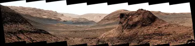
Vermilion Cliffs Highway, Coconino Geology & Natural History
Beyond the trails and wildlife, Vermilion Cliffs Highway sits within a landscape shaped by millions of years of geological processes. Here's what researchers and surveys have documented about this area.
Bedrock Geology
- Rock Type
- Glen Canyon Group
- Formation
- Navajo Sandstone; Kayenta Formation; Moenave Formation
- Lithology
- Major:{sandstone}, Minor:{siltstone,sandstone mudstone}
- Age
- Jurassic
Fossils
- Fossil Occurrences
- 8
- Unique Species
- 7
- Oldest
- 192.9 million years ago
Mineral Deposits
- Deposit Sites
- 3
- Richness
- Low
- Minerals Found
- Uranium, Copper, Molybdenum, Sand and Gravel, Construction
Endangered Species
- Species at Risk
- 1478
- ESA Endangered
- 29
- ESA Threatened
- 16
- Conservation Score
- 100/100
Temperature Records
- Record High
- 104°F (2021-07-10)
- Record Low
- -12°F (2007-01-14)
Wildfire History
This area has a relatively low wildfire risk, but always follow posted fire regulations.
- Recorded Fires
- 24
- Largest Fire
- Warm Wfu (19,514.7 acres)
- Most Recent
- 2024
- Fire Risk
- Extreme
Watershed
- Watershed
- Corral Valley
- Water Quality (Good)
- 0%
- Impaired
- 0%
Reported Phenomena
- Bigfoot Reports
- 1 (BFRO)
- Eeriness Score
- 8/100
Vermilion Cliffs Highway, Coconino Safety & Conditions
Before heading out, check these real-time safety resources for current conditions.
Check these official resources for current conditions at Vermilion Cliffs Highway before you go.
Coordinates: 36.73132, -112.046108