Recorrido Autoguiado - Acequia, Tumacácori NHP
Attractions in Arizona
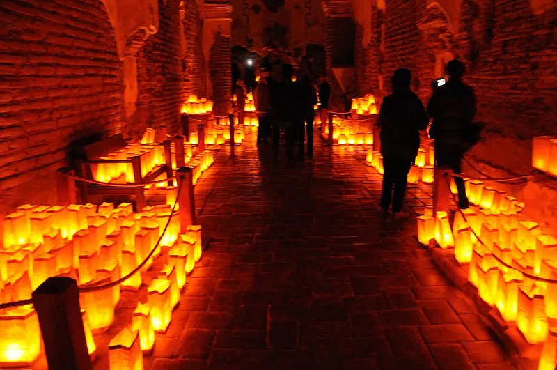
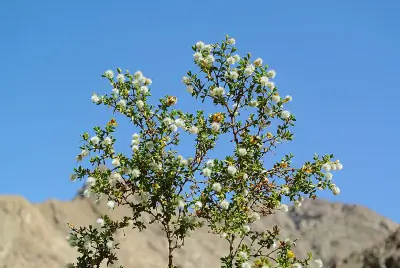
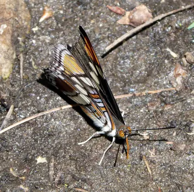
Photo: Packbj / CC BY-SA 3.0
Part of Tumacácori National Historical Park
What to Pack for Recorrido Autoguiado - Acequia, Tumacácori NHP
Being properly equipped turns potential hazards into manageable situations.
Pack for Shrubland terrain, Semi-Arid, and the wildlife considerations above.
Essential
-
Water (minimum 2L) — Dehydration impairs judgment and endurance long before you feel thirsty; 2L is the minimum for a moderate day hike.
-
Navigation (map/GPS/compass) — Phone batteries die, cell service disappears, and trail signs get vandalized; a paper map and compass always work.
-
Sun protection (sunglasses, sunscreen) — UV exposure intensifies at elevation and near reflective surfaces like water and snow; sunburn can happen in under 30 minutes.
-
First aid kit — Blisters, cuts, and sprains happen on even the easiest trails; basic supplies let you treat problems before they force a retreat.
-
Extra food — A wrong turn or unexpected storm can extend any outing by hours; extra calories prevent fatigue and poor decision-making.
-
Headlamp with extra batteries — Trails that seem short in daylight can take twice as long with route-finding or elevation; a headlamp keeps you moving safely after dark.
-
Fire starter — Hypothermia can set in even during summer at higher elevations; a reliable fire starter provides warmth and a signal for rescuers.
-
Emergency shelter (space blanket) — A space blanket weighs under two ounces and reflects up to 90% of body heat, buying time in an unplanned overnight.
-
Knife or multi-tool — From cutting cord to preparing food to improvising gear repairs, a knife is the most versatile tool you can carry.
-
Extra clothing layer — Mountain weather can shift from sunshine to sleet within an hour; an extra layer prevents dangerous heat loss.
Wildlife Gear
-
Hiking buddy (avoid solo) — Groups of three or more are almost never involved in serious bear incidents; larger groups make more noise and appear more intimidating.
-
Noise maker — Clapping, whistling, or using an air horn warns wildlife of your approach, preventing surprise encounters on blind corners.
-
Gaiters — Snake-proof gaiters provide a physical barrier against venomous bites below the knee, where most strikes occur.
-
First-aid snakebite kit — While evacuation to a hospital is the priority, a snakebite kit helps you stay calm and follow proper first-aid protocols.
Seasonal Gear
- Spring: Camera, Wildflower field guide
- Fall: Camera, Binoculars (foliage viewing)
Activities & Best Time to Visit Recorrido Autoguiado - Acequia, Tumacácori NHP
The Shrubland terrain here lends itself to a range of outdoor activities throughout the year.
Whether you're here for hiking or looking to try something different, Recorrido Autoguiado - Acequia has options.
Photographers rate this area 60/100, with Exceptional dark sky (Bortle 1-2) and 2 excellent meteor showers being a major draw.
Activities
-
hiking — Follow marked trails through forests, deserts, or alpine terrain for a deeper connection with nature.
-
photography — Capture landscapes, wildlife, and changing light across trails, coastlines, and mountain vistas.
-
picnicking — Spread a blanket, unpack a meal, and enjoy food outdoors surrounded by fresh air and open views.
-
running — Hit scenic trails or park loops for a workout surrounded by fresh air and open space.
-
walking — A simple way to explore trails, shorelines, and park paths at your own pace while taking in the scenery.
-
wildlife_viewing — Observe animals in their natural habitats, from grazing deer to soaring raptors overhead.
Best months: May, Jun, Jul, Aug, Sep
Terrain: Shrubland — Shrubland consists of low woody vegetation such as chaparral or scrub, often with scattered grasses and minimal tree cover.
Wildlife Safety at Recorrido Autoguiado - Acequia, Tumacácori NHP
Part of visiting responsibly is understanding the wildlife safety considerations for this area.
Most visitors at Recorrido Autoguiado - Acequia never have a wildlife incident, but a danger score of 30/10 means preparation matters.
- Mountain lions
- Venomous snakes
- Remote (143mi from city)
- Exceptional dark sky (Bortle 1-2)
- 2 excellent meteor showers
- Fall foliage
- Spring wildflowers
Venomous Snakes
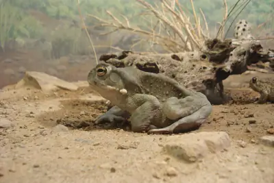
Venomous snakes here include Western Diamondback, Mojave, Sidewinder, Arizona Coral Snake. They're most active during warm months.
A heavy-bodied rattlesnake with bold diamond-shaped blotches along the back and a black-and-white banded tail ending in a rattle.
Remove constrictive items and remain calm; do not cut, suck, or apply ice to the wound.
A large rattlesnake with diamond-like dorsal blotches and a banded tail similar to the Western Diamondback.
Keep the victim calm and monitor breathing while awaiting medical care.
A small pale rattlesnake with horn-like scales above each eye and a sidewinding mode of travel.
Do not attempt to capture the snake; focus on reaching emergency care quickly.
A small slender snake with red, yellow, and black rings around the body.
Keep the victim calm and still while awaiting treatment.
- Watch where you step and place hands
- Stay on trails
- Wear boots and long pants in snake country
- Do not reach under rocks or logs
- If bitten: stay calm, immobilize limb, seek medical help immediately
- Do NOT: cut wound, suck venom, apply tourniquet, ice, or alcohol
Nature & Wildlife at Recorrido Autoguiado - Acequia, Tumacácori NHP
The Shrubland terrain here supports a rich ecosystem worth noticing as you explore.
The Shrubland environment here supports 44 documented species across mammals, birds, reptiles, and amphibians.
Trees (2)
-
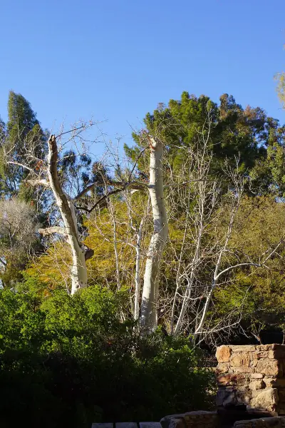 Arizona sycamore — It grows along streams in desert and canyon environments.
 -
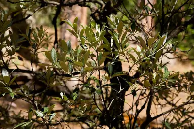 silverleaf oak — It grows in desert mountains of the Southwest.
Wildflowers (1)
-
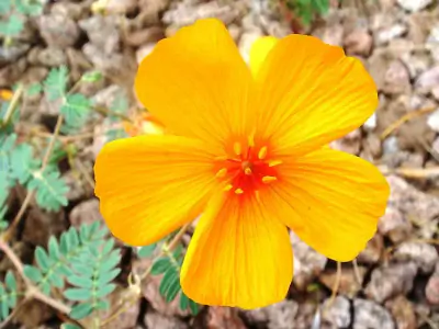 Arizona poppy — Bright orange to yellow cup-shaped flowers.
Shrubs (4)
-
 Creosote Bush — Bright yellow flowers bloom after rain.
 -
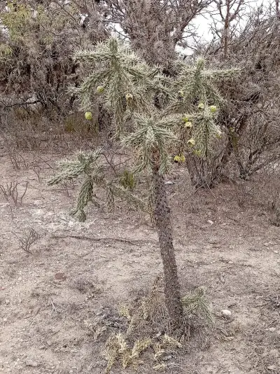 tree cholla — Spiny segments create a dense protective armor. It thrives in desert flats and rocky slopes.
 -
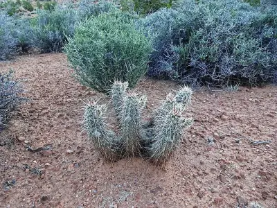 Engelmann's Hedgehog Cactus — The plant rarely exceeds a foot tall but can spread outward in mounded colonies. Its vivid blooms contrast sharply against arid landscapes.
Other Plants (5)
-
fishhook barrel cactus
-
ocotillo
-
rainbow hedgehog cactus
-
Palmer's agave
-
saguaro
Mammals (5)
-
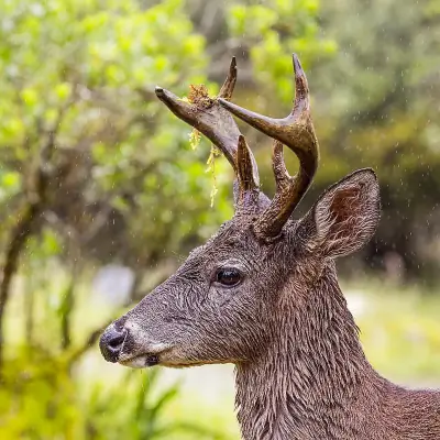 White-tailed Deer — Reddish-brown in summer and grayish in winter with a bright white underside to the tail.
 -
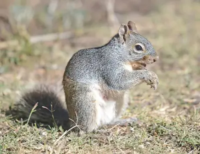 Arizona Gray Squirrel — A large gray squirrel with white underparts and long bushy tail.
 -
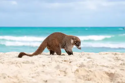 White-nosed Coati — A raccoon-like mammal with long ringed tail and white facial markings.
 -
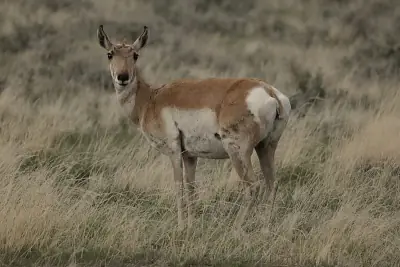 Pronghorn — A slender tan-and-white ungulate with distinctive black facial markings.
 -
 Rock Squirrel — A large ground squirrel with mottled gray-brown fur and bushy tail.
Birds (30)
-
 Ruddy Duck — Breeding male with bright blue bill and chestnut body
 -
 Rock Pigeon — Blue-gray with two black wing bars
 -
 Ring-necked Duck — Male with glossy black head and gray sides
 -
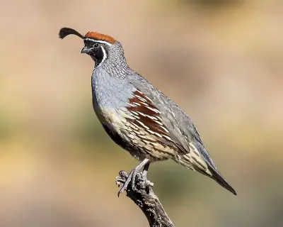 Gambel's Quail — Gray body with chestnut flanks
 -
 Neotropic Cormorant — Small dark cormorant
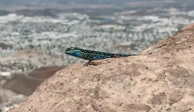
Reptiles (9)
-
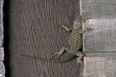 Yarrow's Spiny Lizard — A medium-sized lizard with spiny scales and gray to brown coloring.
 -
 Western Diamond-backed Rattlesnake — A heavy-bodied rattlesnake with bold diamond-shaped dorsal blotches.
 -
 Ornate Tree Lizard — A small spiny lizard with gray to brown coloration and subtle patterning.
 -
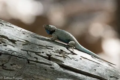 Clark's Spiny Lizard — A medium lizard with rough scales and gray to brown coloration.
 -
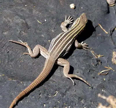 Sonoran Spotted Whiptail — A slender lizard with spotted pattern and faint stripes.
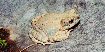
Amphibians (3)
-
 Sonoran Desert Toad
 -
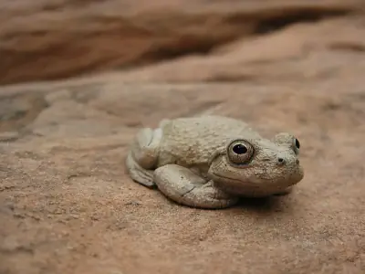 Canyon Tree Frog
 -
 Red-spotted Toad
Insects (20)
-
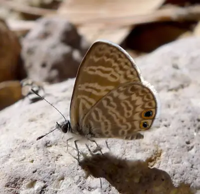 Marine Blue
 -
 Pipevine Swallowtail
 -
 Arizona Sister
 -
 American Snout
 -
 Bordered Patch
Other Wildlife (1)
-
Stripe-tailed Scorpion
Nature Bingo at Recorrido Autoguiado - Acequia, Tumacácori NHP
Can you spot them all? Check off each species as you find it on your visit.
Wildlife Challenge
Botany Challenge
Recorrido Autoguiado - Acequia, Tumacácori NHP Climate & Sun
Reference data: temperatures, precipitation, and daylight hours by month.
The annual average temperature here is 65°F, with 14.9 inches of precipitation.
Climate type: Semi-Arid
Annual avg temp: 65°F
Annual precipitation: 14.9 in
With an average annual temperature of 65°F and 14.9 inches of precipitation, Recorrido Autoguiado - Acequia has warm, dry conditions. Summer highs average around 82°F, while winter lows drop to 49°F.
Best months to visit: Feb, Mar, Apr, May, Oct, Nov.
| Month | Avg Temp | Precip |
|---|---|---|
| Jan | 49°F | 0.8 in |
| Feb | 52°F | 0.9 in |
| Mar | 57°F | 0.8 in |
| Apr | 62°F | 0.3 in |
| May | 70°F | 0.2 in |
| Jun | 79°F | 0.5 in |
| Jul | 82°F | 3.8 in |
| Aug | 81°F | 3.3 in |
| Sep | 76°F | 1.8 in |
| Oct | 67°F | 0.9 in |
| Nov | 57°F | 0.6 in |
| Dec | 49°F | 1.0 in |
Daylight & Sun Times
Daylight ranges from 10.1 hours in winter to 14.2 hours in summer — a difference of 4.1 hours.
Summer: 5:18 AM – 7:29 PM
Winter: 7:16 AM – 5:22 PM
Recorrido Autoguiado - Acequia, Tumacácori NHP Trip Planning & Access
Here's the practical side of visiting Recorrido Autoguiado - Acequia.
Recorrido Autoguiado - Acequia is 143 miles from Phoenix — here's what to budget for the trip.
Visitor Friendliness
This location rates likely_allowed for dogs, excellent for families, and highly_suitable for elderly visitors.
- Dogs: likely_allowed — No restrictions found
- Families: excellent
- Elderly: highly_suitable (Unpaved surface)
- Strollers: possible (50/100)
- Beginners: Good starting point (Moderate difficulty (+5))
- Accessibility: Generally accessible to most visitors (90/100)
Places Near Recorrido Autoguiado - Acequia, Tumacácori NHP
The area around Recorrido Autoguiado - Acequia has plenty more to offer.
If you're exploring this part of Arizona, these nearby spots complement a visit to Recorrido Autoguiado - Acequia.
Nearby Trails
Nearby Campgrounds
- White Rock Campground #2 (N, 0mi), Santa Cruz 12.69 mi
- Calabasas Campground, Santa Cruz 12.7 mi
- Kent Springs Cabin Campground, Santa Cruz 14.65 mi
- Bog Springs Campground, Pima 14.98 mi
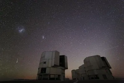
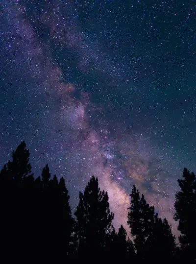
Stargazing & Night Sky at Recorrido Autoguiado - Acequia, Tumacácori NHP
After a day outdoors, the evening sky here is worth a look.
On clear nights, the Bortle class 2 skies above Recorrido Autoguiado - Acequia reveal constellations and bright planets.
Constellations
From Recorrido Autoguiado - Acequia, you can trace Ursa Minor, Cepheus across the sky on clear nights.
-
 Ursa Minor — Home to Polaris, the North Star, Ursa Minor forms a small dipper shape that circles the northern sky year-round.
 -
 Cepheus — Cepheus appears as a faint house-shaped pattern near Polaris in the northern sky.
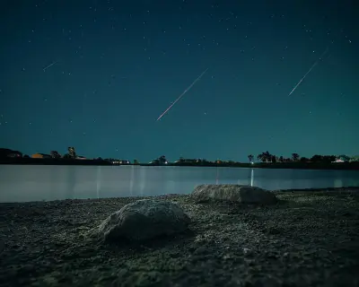
Meteor Showers
Time your visit around December 13-14 for the Geminids, the strongest meteor shower visible from this latitude.
-
 Geminids — peaks December 13-14 (excellent)
One of the most reliable and active showers of the year; best viewed after 10 PM when Gemini rises higher in the sky.
-
 Quadrantids — peaks January 3-4 (excellent)
This brief but intense shower peaks before dawn; early morning hours offer the best chance to see multiple meteors.
-
 Perseids — peaks August 11-13 (good)
A summer favorite with warm nighttime viewing; look northeast after 10 PM.
-
 Eta Aquariids — peaks May 5-6 (good)
Best seen before dawn in the southeastern sky as Aquarius rises.
-
 Delta Aquariids — peaks July 28-29 (fair)
Best viewed after midnight when Aquarius is higher in the southern sky.
Planets
Planets visible to the naked eye from this location:
-
 Venus — The brightest planet, often called the Morning or Evening Star
 -
 Jupiter — The largest planet, bright and steady in the night sky
 -
 Saturn — Famous for its rings, visible as a golden steady light
 -
 Mars — The Red Planet, recognizable by its reddish-orange hue
Equipment Guide
- Naked eye: Venus, Jupiter, Saturn, Mars, Mercury (with care)
- Binoculars: Jupiter moons, Uranus, Saturn rings (barely)
- Small telescope: Saturn rings, Jupiter bands, Mars surface features, Neptune
Viewing Tips
- Check planets rise/set times for your specific date
- Planets appear along the ecliptic (zodiac path)
- Planets don't twinkle like stars - steady light
- Venus and Jupiter are unmistakable - brightest objects after Moon
- Use a stargazing app to confirm planet positions
- Best viewing: when planet is highest in sky (transit)
Best Viewing Months
- Evening: Oct, Nov, Dec, Jan, Feb
- Morning: Jul, Aug, Sep
Seasonal Highlights at Recorrido Autoguiado - Acequia, Tumacácori NHP
The time of year you visit changes what you'll see and do.
Timing your visit to Recorrido Autoguiado - Acequia around seasonal highlights can make a major difference in what you experience.
Spring Wildflowers
Peak bloom: March - April
Check local park websites for bloom reports
Fall Foliage
Peak color: October 25 – November 15
Best trees for color: Maple, Oak, Aspen
Higher elevations peak 1-2 weeks earlier
Bird Migration
Spring peak: March - April
Fall peak: October - November
Best spots: Wetlands, coastlines, mountain ridges
Indigenous Land at Recorrido Autoguiado - Acequia, Tumacácori NHP
Before planning your trip, it's worth recognizing the Indigenous peoples connected to this land.
Before this became a recreation area, this land belonged to O’odham Jeweḍ, Tohono O’odham, Hohokam.
Territories
Languages
Indigenous languages connected to this territory include Tohono O’odham, Pima.
Data from Native Land Digital
Recorrido Autoguiado - Acequia, Tumacácori NHP Geology & Natural History
Beyond the trails and wildlife, Recorrido Autoguiado - Acequia sits within a landscape shaped by millions of years of geological processes. Here's what researchers and surveys have documented about this area.
Bedrock Geology
- Rock Type
- Pliocene to middle Miocene deposits
- Lithology
- Major:{conglomerate,sandstone}, Minor:{mudstone,siltstone,limestone,gypsum}
- Age
- Cenozoic
Mineral Deposits
- Deposit Sites
- 315
- Richness
- Exceptional
- Minerals Found
- Gold, Silver, Copper, Lead, Tungsten, Zinc
Endangered Species
- Species at Risk
- 1478
- ESA Endangered
- 29
- ESA Threatened
- 16
- Conservation Score
- 100/100
Temperature Records
- Record High
- 116°F (1917-06-19)
- Record Low
- 4°F (2013-01-12)
Wildfire History
This area has a relatively low wildfire risk, but always follow posted fire regulations.
- Recorded Fires
- 93
- Largest Fire
- Murphy (70,739.2 acres)
- Most Recent
- 2024
- Fire Risk
- Extreme
Watershed
- Watershed
- Papalote Wash
- Water Quality (Good)
- 0%
- Impaired
- 0%
Meteorite Landings
- Meteorites Found
- 1
- Largest
- Arivaca (0 kg)
Reported Phenomena
- UFO Sightings
- 10 (NUFORC)
- Eeriness Score
- 20/100
Recorrido Autoguiado - Acequia, Tumacácori NHP Safety & Conditions
The weather data above tells you what's typical — these links tell you what's happening right now.
Before visiting Recorrido Autoguiado - Acequia, verify current conditions through these authoritative sources.
Coordinates: 31.568766, -111.049855