Table Top Trail, Pinal
Parks in Arizona
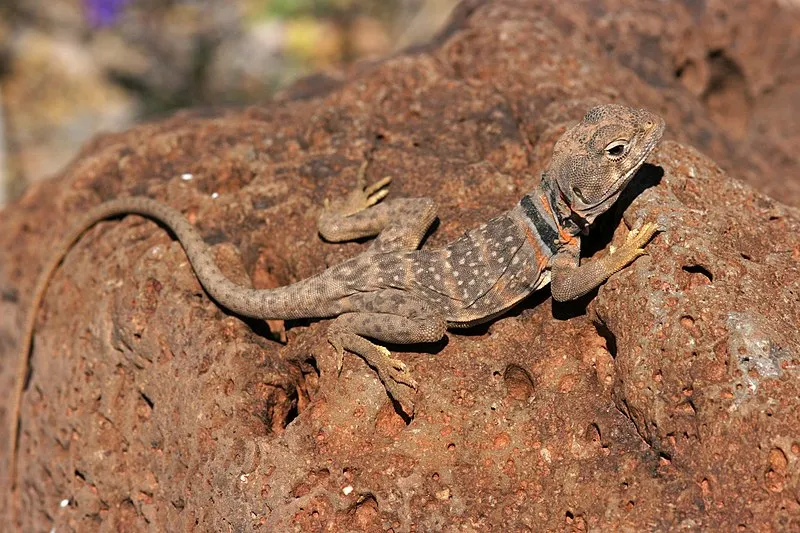
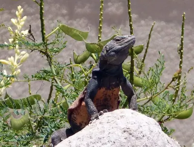
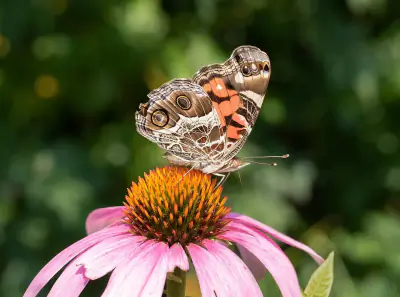
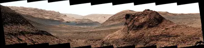
Photo: Patrick Alexander / CC0
Near Stanfield, AZ in Arizona
What to Pack for Table Top Trail, Pinal
Pack with the terrain and wildlife in mind, and you'll be ready for anything here.
Don't underpack for Table Top Trail. The conditions here — Desert, Arid — call for thoughtful gear choices.
Essential
-
Water (minimum 2L) — Even cool-weather hiking demands steady hydration, as exertion and altitude increase water loss faster than most expect.
-
Navigation (map/GPS/compass) — Even well-marked trails have confusing junctions, especially in fog or snow; a GPS unit or downloaded map keeps you on route.
-
Sun protection (sunglasses, sunscreen) — Quality sunglasses prevent snow blindness and reduce eye strain during long days on exposed trails or ridgelines.
-
First aid kit — Adhesive bandages, antiseptic, and athletic tape handle the most common trail injuries and weigh under a pound.
-
Extra food — Blood sugar drops fast during sustained effort outdoors, and having a reserve keeps your body and mind sharp.
-
Headlamp with extra batteries — Batteries drain faster in cold weather; carrying spares ensures you won't be left in the dark when you need light most.
-
Fire starter — Starting a fire boosts morale and provides light, warmth, and a way to purify water in an emergency.
-
Emergency shelter (space blanket) — If an injury forces you to stop moving, a reflective blanket prevents the rapid heat loss that leads to hypothermia.
-
Knife or multi-tool — In a survival situation, a blade lets you process tinder, build shelter, and prepare food.
-
Extra clothing layer — Wet clothing accelerates cooling; a dry backup layer can prevent hypothermia when conditions turn.
Wildlife Gear
-
Hiking buddy (avoid solo) — Solo hikers are more vulnerable to predatory behavior from mountain lions, which typically avoid groups.
-
Noise maker — A loud whistle doubles as a rescue signal, serving both wildlife safety and emergency communication.
-
Gaiters — Beyond snakes, gaiters also protect against thorns, brush, and ticks in overgrown trail sections.
-
First-aid snakebite kit — A lightweight pressure bandage and marker for tracking swelling take up minimal space but provide critical aid.
Terrain Gear
-
Wide-brim hat — Desert and alpine environments with little tree cover leave you fully exposed; a hat is your primary shade source.
-
Sunscreen SPF50+ — Apply 30 minutes before exposure and reapply every 2 hours; sweating and pack straps rub sunscreen off faster than expected.
-
Extra water (desert) — Even well-mapped springs can go dry after low-snowpack years; always carry surplus and check recent trip reports.
Seasonal Gear
- Spring: Camera, Wildflower field guide
- Fall: Camera, Binoculars (foliage viewing)
Activities & Best Time to Visit Table Top Trail, Pinal
The Desert terrain here lends itself to a range of outdoor activities throughout the year.
Activity options at Table Top Trail range from casual () to more demanding ().
The scenery here earns a 45/100 photography rating — Decent dark sky (Bortle 5) and 3 excellent meteor showers.
Activities
-
backpacking — Lightweight equipment and route awareness are key for safe travel.
-
hiking — With sturdy footwear and preparation, trails open up expansive views and quiet solitude.
-
horseback_riding — Guided rides are available in many parks and recreation areas.
-
ice_fishing — Portable shelters help protect against cold winds.
-
ice_skating — Ensure ice thickness and safety before skating on natural surfaces.
-
photography — Outdoor photography invites you to slow down and frame the beauty around you.
-
picnicking — Whether lakeside or in a meadow, it's a relaxed way to savor both the setting and the company.
-
rv_camping — Hookups and designated sites make extended stays convenient.
-
sightseeing — It's an accessible way to appreciate the character of a place.
-
walking — Perfect for all ages, a casual walk can turn any outdoor space into a relaxing nature experience.
-
wildlife_viewing — Bring binoculars and patience — nature often rewards careful, respectful observers.
Best months: May, Jun, Jul, Aug, Sep
Terrain: Desert — Rocky outcrops, sand, and dry washes are common features.
Wildlife Safety at Table Top Trail, Pinal
Before heading out, it helps to know which wildlife to be cautious around.
Responsible visitors at Table Top Trail should be aware of 1 wildlife-related considerations.
- Mountain lions
- Venomous snakes
- Far from city (51mi)
- Decent dark sky (Bortle 5)
- 3 excellent meteor showers
- Fall foliage
- Spring wildflowers
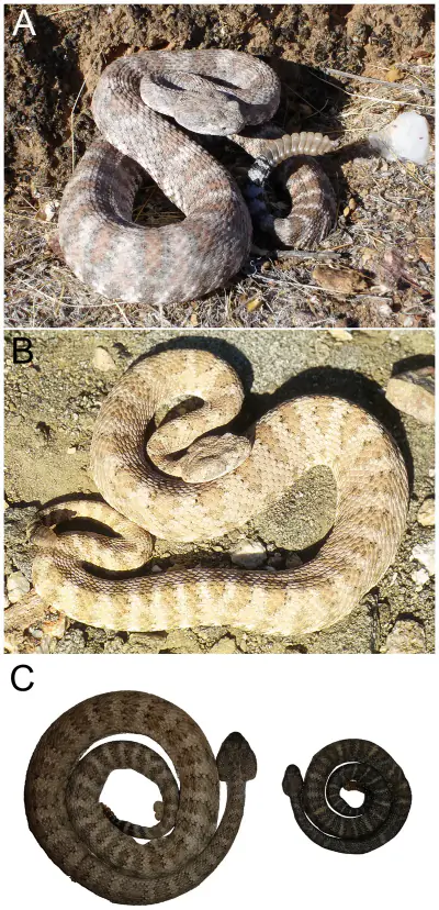
Venomous Snakes
4 venomous snake species are found in this area: Western Diamondback, Mojave, Sidewinder, Arizona Coral Snake.
Broad triangular head, vertical pupils, and a stout body often exceeding 3 to 4 feet in length.
Remove constrictive items and remain calm; do not cut, suck, or apply ice to the wound.
Distinct facial stripe behind the eye and a prominent rattle.
Keep the victim calm and monitor breathing while awaiting medical care.
Usually under 2 feet long with a relatively short rattle.
Do not attempt to capture the snake; focus on reaching emergency care quickly.
Head is blunt with a black snout.
Keep the victim calm and still while awaiting treatment.
- Watch where you step and place hands
- Stay on trails
- Wear boots and long pants in snake country
- Do not reach under rocks or logs
- If bitten: stay calm, immobilize limb, seek medical help immediately
- Do NOT: cut wound, suck venom, apply tourniquet, ice, or alcohol
Nature & Wildlife at Table Top Trail, Pinal
The Desert terrain here supports a rich ecosystem worth noticing as you explore.
From towering elephant tree to delicate California poppy and Emory's rockdaisy, the vegetation here creates habitat for 4 mammal species and 30 birds.
Trees (1)
-
 elephant tree — Leaves are small and aromatic.
Wildflowers (3)
-
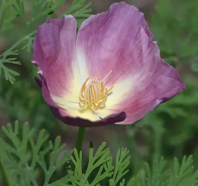 California poppy — Four-petaled blooms that close at night or in cool weather.
 -
 Emory's rockdaisy — Daisy-like blooms arising from rocky crevices.
 -
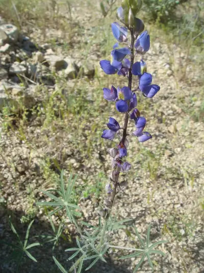 Coulter's lupine — Purple to blue pea-like flowers form tall spikes.
Shrubs (3)
-
 Creosote Bush — Bright yellow flowers bloom after rain.
 -
 Brittlebush — Leaves are soft and pale gray, contrasting with long-stemmed golden blooms.
 -
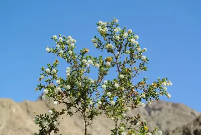
 Engelmann's Hedgehog Cactus — Ribbed stems grow close to the ground and may form tight clusters over time. Spines range from straw-colored to reddish brown, offering protection from herbivores.
Other Plants (5)
-
saguaro
-
stinknet
-
California Barrel Cactus
-
Buckhorn Cholla
-
Graham's nipple cactus
Mammals (4)
-
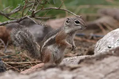 Harris' Antelope Squirrel — Slender body built for heat tolerance.
 -
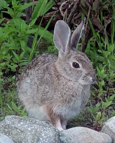 Desert Cottontail — Long hind legs for rapid escape.
 -
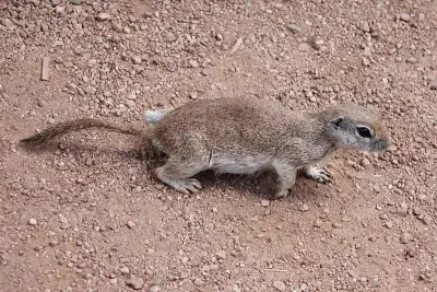 Round-tailed Ground Squirrel — Compact build.
 -
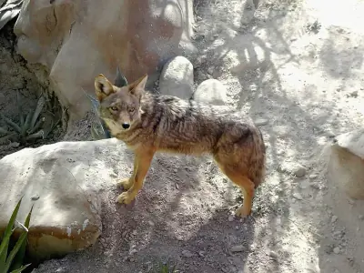 Coyote — Lean, agile build.
Birds (30)
-
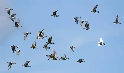 Rock Pigeon — Dark charcoal form with iridescent neck
 -
 European Starling — Sleek dark breeding plumage with yellow bill
 -
 Dark-eyed Junco — Pink-sided form with pale gray and buff flanks
 -
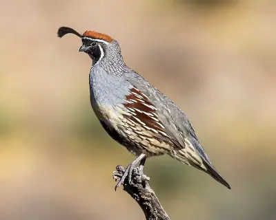 Gambel's Quail — Forward-curving head plume
 -
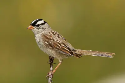 White-crowned Sparrow — Gray breast and pink bill
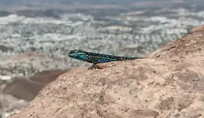
Reptiles (6)
-
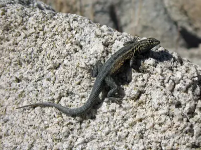 Common Side-blotched Lizard — Typically 4–6 inches long including the tail.
 -
 Common Chuckwalla — Often 12–16 inches long.
 -
 Ornate Tree Lizard — Typically 4–6 inches long.
 -
 Southwestern Speckled Rattlesnake — Typically 2–3 feet long.
 -
 Western Diamond-backed Rattlesnake — Adults commonly 3–5 feet long.
Insects (10)
-
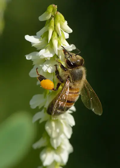 Western Honey Bee
 -
 Painted Lady
 -
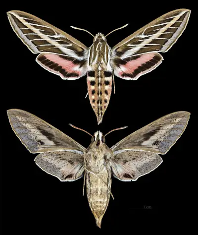 White-lined Sphinx
 -
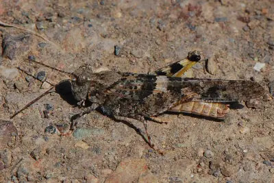 Pallid-winged Grasshopper
 -
 Queen
Queen
Other Wildlife (1)
-
Stripe-tailed Scorpion
Nature Bingo at Table Top Trail, Pinal
Can you spot them all? Check off each species as you find it on your visit.
Wildlife Challenge
Botany Challenge
Table Top Trail, Pinal Climate & Sun
The numbers behind the best (and worst) times to visit Table Top Trail.
Reference climate data for planning your visit to Table Top Trail — temperatures, precipitation, and daylight hours.
Climate type: Arid
Annual avg temp: 69.8°F
Annual precipitation: 9.2 in
With an average annual temperature of 69.8°F and 9.2 inches of precipitation, Table Top Trail has warm, arid conditions. Summer highs average around 89°F, while winter lows drop to 52°F.
Best months to visit: Jan, Feb, Mar, Apr, May, Oct, Nov, Dec.
| Month | Avg Temp | Precip |
|---|---|---|
| Jan | 52°F | 0.9 in |
| Feb | 55°F | 1.0 in |
| Mar | 61°F | 1.0 in |
| Apr | 67°F | 0.2 in |
| May | 75°F | 0.2 in |
| Jun | 85°F | 0.1 in |
| Jul | 89°F | 1.1 in |
| Aug | 88°F | 1.7 in |
| Sep | 83°F | 0.8 in |
| Oct | 72°F | 0.6 in |
| Nov | 60°F | 0.6 in |
| Dec | 51°F | 1.0 in |
Daylight & Sun Times
Daylight ranges from 10 hours in winter to 14.3 hours in summer — a difference of 4.3 hours.
Summer: 5:19 AM – 7:37 PM
Winter: 7:23 AM – 5:24 PM
Table Top Trail, Pinal Trip Planning & Access
Time to plan the details — access, cost, and travel information for your visit.
Here are the logistics for getting to Table Top Trail and what to expect on arrival.
Visitor Friendliness
Accessibility: dog-friendly (likely_allowed), family-friendly (excellent), elderly-friendly (highly_suitable).
- Dogs: likely_allowed — No restrictions found
- Families: excellent
- Elderly: highly_suitable
- Strollers: excellent (100/100)
- Beginners: Perfect for beginners (Moderate difficulty (+5), Good information available (+5))
- Accessibility: Generally accessible to most visitors (90/100)
Places Near Table Top Trail, Pinal
Looking for more? Here's what else is close by.
Close-by alternatives and additions to your Table Top Trail visit include these 2 destinations.
Nearby Attractions
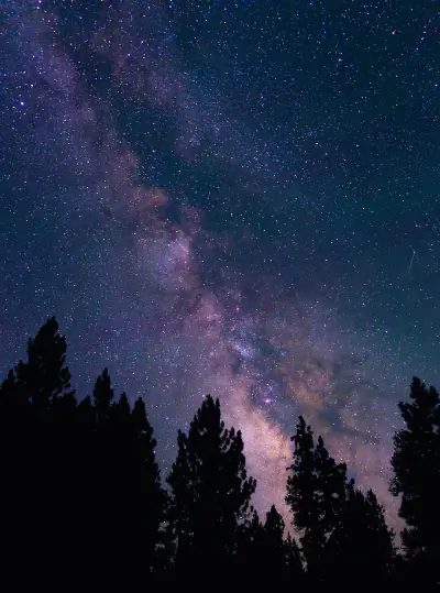
Stargazing & Night Sky at Table Top Trail, Pinal
Clear nights in this area reveal more stars than most people expect.
The darkness at Table Top Trail is rated Bortle class 5, offering Suburban sky conditions year-round.
Constellations
Key constellations visible from this latitude include Ursa Minor, Cepheus.
-
 Ursa Minor — Visible throughout the year in much of the United States, Ursa Minor rotates steadily around the North Celestial Pole.
 -
 Cepheus — Though its stars are modest in brightness, Cepheus is visible year-round from most of the U.S.
Meteor Showers
The Geminids peaks around December 13-14 and is the best meteor shower visible from here.
-
 Geminids — peaks December 13-14 (excellent)
Find a dark location away from city lights and give your eyes 20–30 minutes to adjust for peak rates.
-
 Quadrantids — peaks January 3-4 (excellent)
Look toward the northern sky after midnight for the highest activity.
-
 Perseids — peaks August 11-13 (excellent)
Expect fast, bright meteors and occasional fireballs under dark skies.
-
 Eta Aquariids — peaks May 5-6 (good)
Plan for early morning viewing; activity increases in the hours just before sunrise.
-
 Delta Aquariids — peaks July 28-29 (fair)
Southern states often see stronger activity due to radiant placement.
Planets
Planets visible to the naked eye from this location:
-
 Venus — The brightest planet, often called the Morning or Evening Star
 -
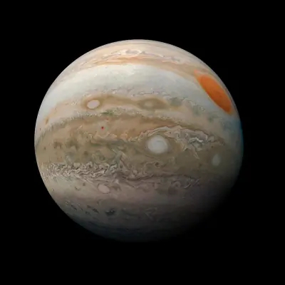 Jupiter — The largest planet, bright and steady in the night sky
 -
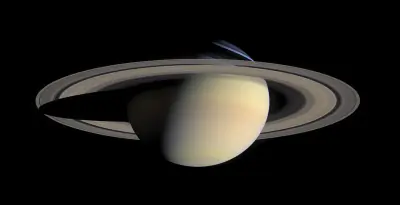 Saturn — Famous for its rings, visible as a golden steady light
 -
 Mars — The Red Planet, recognizable by its reddish-orange hue
Equipment Guide
- Naked eye: Venus, Jupiter, Saturn, Mars, Mercury (with care)
- Binoculars: Jupiter moons, Uranus, Saturn rings (barely)
- Small telescope: Saturn rings, Jupiter bands, Mars surface features, Neptune
Viewing Tips
- Check planets rise/set times for your specific date
- Planets appear along the ecliptic (zodiac path)
- Planets don't twinkle like stars - steady light
- Venus and Jupiter are unmistakable - brightest objects after Moon
- Use a stargazing app to confirm planet positions
- Best viewing: when planet is highest in sky (transit)
Best Viewing Months
- Evening: Oct, Nov, Dec, Jan, Feb
- Morning: Jul, Aug, Sep
Seasonal Highlights at Table Top Trail, Pinal
What you'll encounter here shifts with the calendar — here's a seasonal overview.
The experience at Table Top Trail shifts with the seasons. Here's a month-by-month overview.
Spring Wildflowers
Peak bloom: March - April
Check local park websites for bloom reports
Fall Foliage
Peak color: October 25 – November 15
Best trees for color: Maple, Oak, Aspen
Higher elevations peak 1-2 weeks earlier
Bird Migration
Spring peak: March - April
Fall peak: October - November
Best spots: Wetlands, coastlines, mountain ridges
Indigenous Land at Table Top Trail, Pinal
The history of this land reaches back long before it became a recreation destination.
Before trails were marked here, O’odham Jeweḍ, Akimel O’odham (Upper Pima), Tohono O’odham knew this land intimately.
Languages
The languages traditionally spoken in this area include Tohono O’odham, Maricopa, O’odham.
Data from Native Land Digital
Table Top Trail, Pinal Geology & Natural History
Beyond the trails and wildlife, Table Top Trail sits within a landscape shaped by millions of years of geological processes. Here's what researchers and surveys have documented about this area.
Bedrock Geology
- Rock Type
- Quaternary surficial deposits, undivided
- Lithology
- Major:{sand,silt,clay}
- Age
- Cenozoic
Mineral Deposits
- Deposit Sites
- 54
- Richness
- Exceptional
- Minerals Found
- Sand and Gravel, Construction, Copper, Silver, Iron, Gold, Silica, Molybdenum
Endangered Species
- Species at Risk
- 1478
- ESA Endangered
- 29
- ESA Threatened
- 16
- Conservation Score
- 100/100
Temperature Records
- Record High
- 122°F (1907-07-03)
- Record Low
- 8°F (1950-01-06)
Wildfire History
This area has a moderate wildfire risk. Be aware of fire restrictions during dry months and practice safe fire practices.
- Recorded Fires
- 2
- Largest Fire
- Haley (356.6 acres)
- Most Recent
- 2024
- Fire Risk
- Moderate
Watershed
- Watershed
- Needle Peak-Santa Rosa Wash
- Water Quality (Good)
- 0%
- Impaired
- 0%
Reported Phenomena
- UFO Sightings
- 1 (NUFORC)
- Eeriness Score
- 2/100
Table Top Trail, Pinal Safety & Conditions
Plans set? Check the latest conditions before you head out.
Before any visit to Table Top Trail, a quick check of these official sources can prevent surprises.
Coordinates: 32.716428, -112.159573