Merganser Trailhead (E, 0mi), Coconino
Trails in Arizona
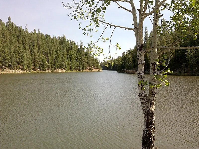
Photo: davidpinter / CC BY 3.0
What to Pack for Merganser Trailhead (E, 0mi), Coconino
Being properly equipped turns potential hazards into manageable situations.
This packing list is tailored to the Forest environment and variable conditions at Merganser Trailhead.
Essential
-
Water (minimum 2L) — Dehydration impairs judgment and endurance long before you feel thirsty; 2L is the minimum for a moderate day hike.
-
Navigation (map/GPS/compass) — Phone batteries die, cell service disappears, and trail signs get vandalized; a paper map and compass always work.
-
Sun protection (sunglasses, sunscreen) — UV exposure intensifies at elevation and near reflective surfaces like water and snow; sunburn can happen in under 30 minutes.
-
First aid kit — Blisters, cuts, and sprains happen on even the easiest trails; basic supplies let you treat problems before they force a retreat.
-
Extra food — A wrong turn or unexpected storm can extend any outing by hours; extra calories prevent fatigue and poor decision-making.
-
Headlamp with extra batteries — Trails that seem short in daylight can take twice as long with route-finding or elevation; a headlamp keeps you moving safely after dark.
-
Fire starter — Hypothermia can set in even during summer at higher elevations; a reliable fire starter provides warmth and a signal for rescuers.
-
Emergency shelter (space blanket) — A space blanket weighs under two ounces and reflects up to 90% of body heat, buying time in an unplanned overnight.
-
Knife or multi-tool — From cutting cord to preparing food to improvising gear repairs, a knife is the most versatile tool you can carry.
-
Extra clothing layer — Mountain weather can shift from sunshine to sleet within an hour; an extra layer prevents dangerous heat loss.
Terrain Gear
-
Headlamp (extra) — Remote terrain often takes longer than expected to navigate; a backup headlamp prevents being stranded in darkness if your primary fails.
-
Emergency bivy — An emergency bivy sack weighs 4-8 ounces and provides wind and rain protection if an injury, storm, or navigation error forces an unplanned night out.
-
PLB/satellite messenger — A Personal Locator Beacon sends your GPS coordinates to search-and-rescue via satellite, working anywhere on Earth with no cell signal needed.
Seasonal Gear
- Spring: Camera, Wildflower field guide
- Fall: Camera, Binoculars (foliage viewing)
Activities & Best Time to Visit Merganser Trailhead (E, 0mi), Coconino
The Forest terrain here lends itself to a range of outdoor activities throughout the year.
The terrain here lends itself to backpacking, hiking, photography — activities that match the Forest environment.
Photographers rate this area 20/100, with Fall foliage and Spring wildflowers being a major draw.
Activities
-
backpacking — Carry your gear into the backcountry for multi-day hiking adventures.
-
hiking — Follow marked trails through forests, deserts, or alpine terrain for a deeper connection with nature.
-
photography — Capture landscapes, wildlife, and changing light across trails, coastlines, and mountain vistas.
-
picnicking — Spread a blanket, unpack a meal, and enjoy food outdoors surrounded by fresh air and open views.
-
walking — A simple way to explore trails, shorelines, and park paths at your own pace while taking in the scenery.
-
wildlife_viewing — Observe animals in their natural habitats, from grazing deer to soaring raptors overhead.
Best months: Oct, Nov, Dec, Jan, Feb, Mar, Apr
Terrain: Forest — Forests are dominated by dense tree cover, layered canopies, and shaded understories. Ground conditions vary from leaf litter to mossy soils, with limited visibility off trail.
Merganser Trailhead (E, 0mi), Coconino Trip Planning & Access
Here's the practical side of visiting Merganser Trailhead.
Whether it's a day trip or weekend getaway from Phoenix, here's what visiting Merganser Trailhead involves.
Visitor Friendliness
This location rates likely_allowed for dogs, excellent for families, and highly_suitable for elderly visitors.
- Dogs: likely_allowed — No restrictions found
- Families: excellent
- Elderly: highly_suitable
- Strollers: excellent (100/100)
- Beginners: Good starting point
- Accessibility: Generally accessible to most visitors (95/100)
Seasonal Highlights at Merganser Trailhead (E, 0mi), Coconino
The time of year you visit changes what you'll see and do.
Knowing what each season brings helps you plan the best possible visit to Merganser Trailhead.
Spring Wildflowers
Peak bloom: March - April
Check local park websites for bloom reports
Fall Foliage
Peak color: October 15 – November 5
Best trees for color: Maple, Oak, Aspen
Higher elevations peak 1-2 weeks earlier
Bird Migration
Spring peak: March - April
Fall peak: October - November
Best spots: Wetlands, coastlines, mountain ridges
Merganser Trailhead (E, 0mi), Coconino Safety & Conditions
The weather data above tells you what's typical — these links tell you what's happening right now.
Safety starts with current information. These resources cover real-time conditions near Merganser Trailhead.
Coordinates: 34.401003, -111.004053