Los Burros #2 Trailhead, Apache
Trailheads in Arizona
Near Mcnary, AZ in Arizona
What to Pack for Los Burros #2 Trailhead, Apache
A well-packed bag handles most of what this area can throw at you.
Between the Forest terrain and venomous snakes, your pack for Los Burros #2 needs a few specific items.
Essential
-
Water (minimum 2L) — Water sources marked on maps may be seasonal or dry; carrying enough to complete your route prevents a dangerous shortfall.
-
Navigation (map/GPS/compass) — Getting lost is the leading cause of backcountry search-and-rescue calls; reliable navigation prevents the situation entirely.
-
Sun protection (sunglasses, sunscreen) — Prolonged sun exposure causes headaches, fatigue, and heat exhaustion that can cut a trip short or create a medical emergency.
-
First aid kit — Remote locations mean longer response times for help; a first aid kit bridges the gap between injury and professional care.
-
Extra food — High-energy snacks weigh little but provide crucial fuel if you need to bushwhack out or wait for conditions to improve.
-
Headlamp with extra batteries — Hands-free light is essential for navigating uneven terrain, setting up camp, or signaling for help at night.
-
Fire starter — Waterproof matches or a ferro rod weigh almost nothing and can be the difference between a cold night and a survivable one.
-
Emergency shelter (space blanket) — Wind and rain strip heat faster than most people realize; a compact emergency shelter blocks both.
-
Knife or multi-tool — A multi-tool handles problems you can't predict: jammed zippers, tangled line, first-aid tape cutting, or gear fixes on the trail.
-
Extra clothing layer — A lightweight fleece or puffy stuffs small but provides critical insulation if temperatures drop unexpectedly.
Wildlife Gear
-
Hiking buddy (avoid solo) — A companion can help with first aid, signaling, and decision-making if a wildlife encounter turns serious.
-
Noise maker — Group noise is especially important in dense brush or near berry patches where bears may be feeding and less alert.
-
Gaiters — Thick gaiters deflect fangs before they reach skin, buying critical time in areas with rattlesnakes or copperheads.
-
First-aid snakebite kit — Knowing how to immobilize a limb, mark swelling progression, and avoid harmful folk remedies can improve outcomes.
Climate Gear
-
Insulated layers — Modern synthetic or down insulation packs small and weighs little, making it easy to carry just in case.
-
Hand warmers — Disposable warmers weigh almost nothing and provide 8+ hours of steady heat in gloves or pockets.
-
Thermos — In freezing conditions, warm liquids help prevent the calorie drain your body spends on staying warm.
Terrain Gear
-
Headlamp (extra) — Cave exploration, deep canyons, and dense forest canopy create darkness even during daylight hours.
-
Emergency bivy — Unlike a space blanket, a bivy fully encloses you, trapping more warmth and blocking wind from all directions.
-
PLB/satellite messenger — In remote wilderness with no cell coverage, a PLB is your only way to call for help during a serious injury or emergency.
Seasonal Gear
- Spring: Camera, Wildflower field guide
- Fall: Camera, Binoculars (foliage viewing)
Activities & Best Time to Visit Los Burros #2 Trailhead, Apache
The Forest terrain here lends itself to a range of outdoor activities throughout the year.
Oct, Nov, Dec, Jan, Feb, Mar, Apr is the prime window for visiting Los Burros #2, when conditions favor backpacking and the weather cooperates.
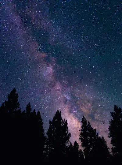
With a photography score of 65/100, Los Burros #2 offers Exceptional dark sky (Bortle 1-2) and 3 excellent meteor showers worth capturing.
Activities
-
backpacking — Backpacking combines endurance, planning, and remote wilderness camping.
-
hiking — Hiking ranges from gentle nature walks to challenging summit climbs.
-
photography — Golden hour and dramatic weather can transform ordinary scenes into striking images.
-
picnicking — Picnicking turns a scenic overlook or shady grove into a memorable gathering spot.
-
walking — Walking lets you slow down and notice details — wildflowers, birdsong, shifting light through trees.
-
wildlife_viewing — Early mornings and dusk offer the best chances to quietly spot native wildlife.
Best months: Oct, Nov, Dec, Jan, Feb, Mar, Apr
Terrain: Forest — This terrain features mature trees, fallen logs, and filtered light beneath a closed canopy. Trails may wind through uneven roots and soft organic soil.
Wildlife Safety at Los Burros #2 Trailhead, Apache
A few species in this area warrant awareness — here's what to keep in mind.
Los Burros #2 carries a danger score of 30/10, driven primarily by venomous snakes.
- Mountain lions
- Venomous snakes
- Remote (141mi from city)
- Exceptional dark sky (Bortle 1-2)
- 3 excellent meteor showers
- Fall foliage
- Spring wildflowers
Venomous Snakes
Watch your step — are present in the Forest habitat around Los Burros #2.
- Watch where you step and place hands
- Stay on trails
- Wear boots and long pants in snake country
- Do not reach under rocks or logs
- If bitten: stay calm, immobilize limb, seek medical help immediately
- Do NOT: cut wound, suck venom, apply tourniquet, ice, or alcohol
Nature & Wildlife at Los Burros #2 Trailhead, Apache
The Forest terrain here supports a rich ecosystem worth noticing as you explore.
Biodiversity at Los Burros #2 is shaped by the Forest terrain and Temperate climate, producing distinct plant and animal communities.
Trees (2)
-
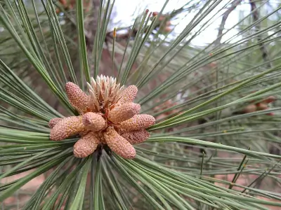 Southwestern Ponderosa Pine — Southwestern Ponderosa Pine is a large, long-needled conifer adapted to dry, high-elevation forests.
 -
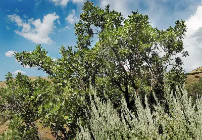 Gambel Oak — Gambel oak is a small to medium deciduous tree with deeply lobed leaves that resemble classic oak shapes.
Wildflowers (5)
-
 Woods' rose — Arching thorny stems with pinnate leaves.
 -
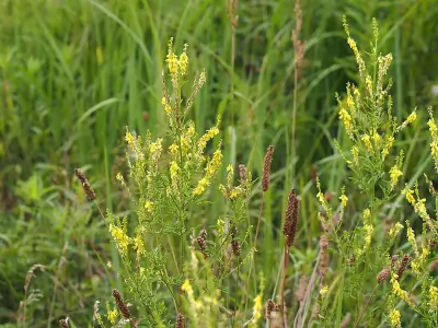 Yellow Sweetclover — Trifoliate leaves and upright branching growth.
 -
 alpine cancer-root — Alpine cancer-root is a leafless parasitic plant with reddish stems.
 -
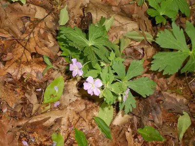 pinewoods geranium — Pinewoods geranium produces pink to lavender five-petaled flowers.
 -
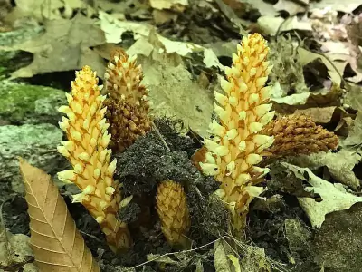
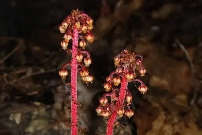 woodland pinedrops — Woodland pinedrops is a tall, leafless perennial that emerges as a reddish or yellowish stalk up to 3 feet high. It lacks chlorophyll and does not photosynthesize.
Other Plants (5)
-
great mullein
-
Scarlet Gilia
-
western blue flag
-
alligator juniper
-
Spinystar
Mammals (6)
-
 Abert's Squirrel — White underside and bushy tail edged in white.
 -
 Common Golden-mantled Ground Squirrel — Two bold stripes run along the back but none on the face.
 -
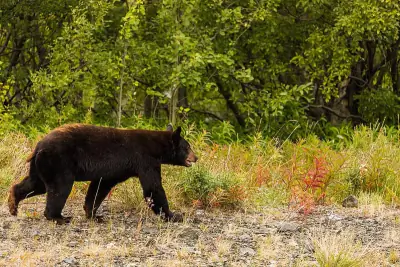 American Black Bear — Color varies from jet black to cinnamon or even blond.
 -
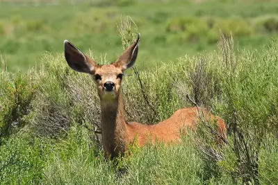 Mule Deer — Coat ranges from tawny brown in summer to gray-brown in winter.
 -
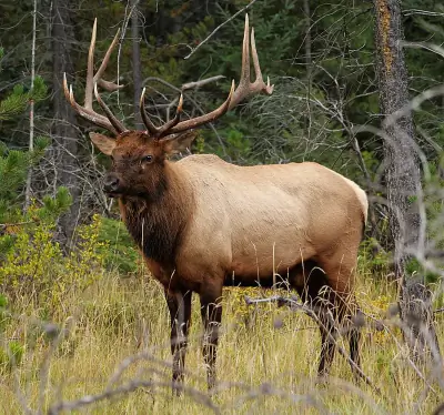 Wapiti — Bulls carry massive branching antlers that can span over four feet.
Birds (30)
-
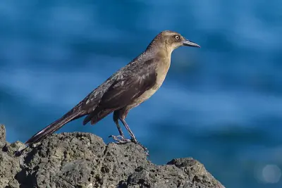 Great-tailed Grackle — Brown female
 -
 Dark-eyed Junco — Oregon form with dark hood and brown back
 -
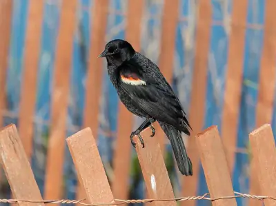 Red-winged Blackbird — Streaked brown female
 -
 Gadwall — Mottled brown female
 -
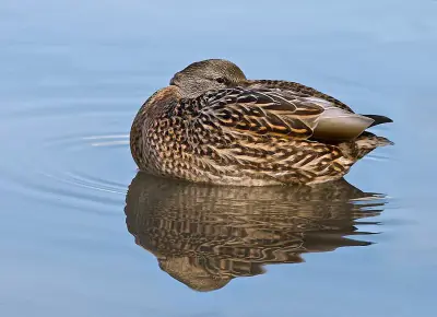 Mallard — Mottled brown female with orange bill
Reptiles (5)
-
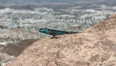
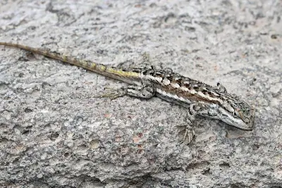 Plateau Fence Lizard — Males show blue belly patches.
 -
 Greater Short-horned Lizard — Color matches surrounding soil in browns and grays.
 -
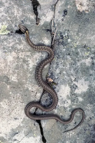 Western Terrestrial Garter Snake — Often displays small black spots between the stripes.
 -
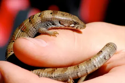 Madrean Alligator Lizard — Olive to brown coloration.
 -
 Ornate Tree Lizard — Males may show bluish patches on the belly.
Amphibians (3)
-
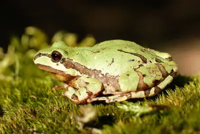 Arizona Tree Frog
 -
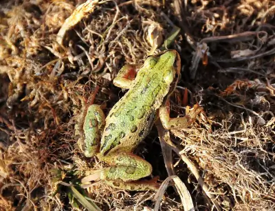 Boreal Chorus Frog
 -
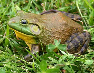 American Bullfrog
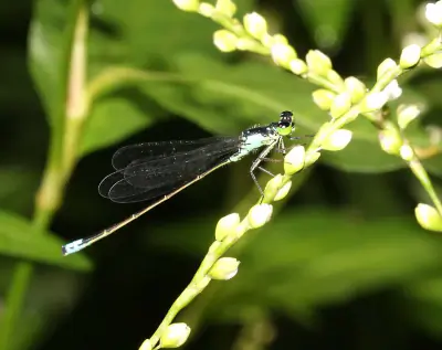
Insects (15)
-
 Springwater Dancer
 -
 Plains Forktail
 -
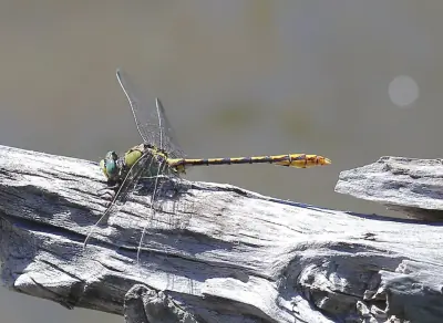 Arizona Snaketail
 -
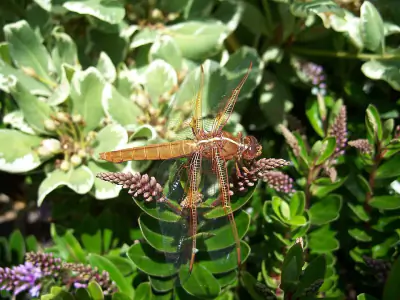 Flame Skimmer
 -
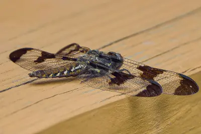 Common Whitetail
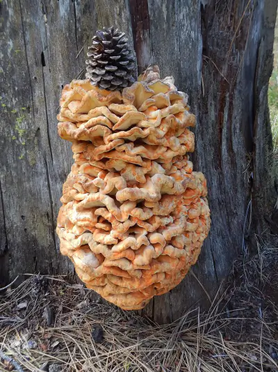
Fungi (3)
-
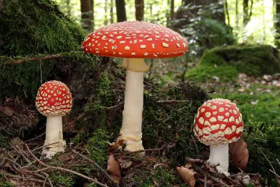 Fly Agaric
 -
 lobster mushroom
 -
 Spring Polypore
Other Wildlife (1)
-
Virile Crayfish
Nature Bingo at Los Burros #2 Trailhead, Apache
Can you spot them all? Check off each species as you find it on your visit.
Wildlife Challenge
Botany Challenge
Los Burros #2 Trailhead, Apache Climate & Sun
Use this climate breakdown to plan around the weather.
Temperature and precipitation data for Los Burros #2 help narrow down the ideal visit window.
Climate type: Temperate
Best months to visit: May, Jun, Sep, Oct.
| Month | Avg Temp | Precip |
|---|---|---|
| Jan | 31°F | 2.1 in |
| Feb | 35°F | 1.6 in |
| Mar | 40°F | 1.5 in |
| Apr | 46°F | 0.6 in |
| May | 53°F | 0.7 in |
| Jun | 65°F | 0.4 in |
| Jul | 66°F | 4.5 in |
| Aug | 65°F | 4.4 in |
| Sep | 60°F | 2.1 in |
| Oct | 51°F | 1.3 in |
| Nov | 41°F | 1.4 in |
| Dec | 32°F | 2.8 in |
Daylight & Sun Times
Daylight ranges from 9.9 hours in winter to 14.4 hours in summer — a difference of 4.5 hours.
Summer: 5:06 AM – 7:31 PM
Winter: 7:17 AM – 5:11 PM
Los Burros #2 Trailhead, Apache Trip Planning & Access
With the lay of the land covered, here are the trip planning details.
At 141 miles from Phoenix, Los Burros #2 is a short road trip for most visitors.
Visitor Friendliness
Visitor friendliness: families (excellent), dogs (likely_allowed), elderly (highly_suitable).
- Dogs: likely_allowed — No restrictions found
- Families: excellent
- Elderly: highly_suitable
- Strollers: excellent (100/100)
- Beginners: Good starting point
- Accessibility: Generally accessible to most visitors (95/100)
Places Near Los Burros #2 Trailhead, Apache
Nearby trails, campgrounds, and attractions expand what you can do on this trip.
Don't limit your trip to just Los Burros #2 — the surrounding area has 13 more places to discover.
Nearby Trails
- Four Springs Trail, Apache 0.56 mi
- Four Springs Connector, Apache 0.67 mi
- Los Burros Trail, Apache 1.13 mi
- Los Burros Shortcut Trail, Apache 1.23 mi
- Pioneers Shortcut #1 Trail, Apache 4.48 mi
Nearby Campgrounds
- Los Burros Campground, Apache 0.96 mi
- Los Burros #1 Campground, Apache 1.13 mi
- Brown Creek Campground, Apache 2.85 mi
- Scott Reservoir, Navajo 11.36 mi
- Lakeside Campground, Navajo 12.32 mi
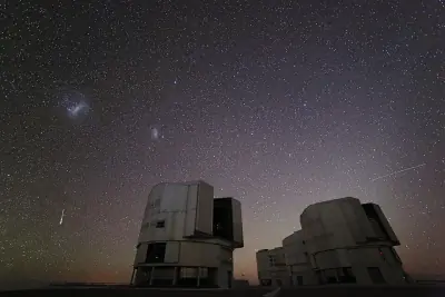
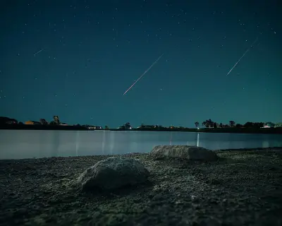
Stargazing & Night Sky at Los Burros #2 Trailhead, Apache
Don't pack up when the sun goes down — the night sky here has plenty to offer.
Night falls differently here — the Bortle 2 rating means Typical truly dark site visibility for stars, planets, and meteor showers.
Constellations
Look for Ursa Minor, Cepheus — all visible from this location depending on the season.
-
 Ursa Minor — This compact constellation contains Polaris at the end of its handle, a reliable guide to true north.
 -
 Cepheus — Named for a mythological king, this constellation sits beside Cassiopeia and is circumpolar in northern latitudes.
Meteor Showers
For meteor viewing, the Geminids (December 13-14) offers the best show at this location.
-
 Geminids — peaks December 13-14 (excellent)
Cold December air often means clear skies—look overhead after midnight for bright, slow-moving meteors.
-
 Quadrantids — peaks January 3-4 (excellent)
Bundle up—January nights are frigid, but dark skies can produce bright fireballs.
-
 Perseids — peaks August 11-13 (excellent)
Peak activity typically builds after midnight when Perseus climbs higher.
-
 Eta Aquariids — peaks May 5-6 (good)
Southern U.S. observers often get better rates due to the radiant's position.
-
 Delta Aquariids — peaks July 28-29 (fair)
This steady shower rewards patient observers in dark, moonless conditions.
Planets
Planets visible to the naked eye from this location:
-
 Venus — The brightest planet, often called the Morning or Evening Star
 -
 Jupiter — The largest planet, bright and steady in the night sky
 -
 Saturn — Famous for its rings, visible as a golden steady light
 -
 Mars — The Red Planet, recognizable by its reddish-orange hue
Equipment Guide
- Naked eye: Venus, Jupiter, Saturn, Mars, Mercury (with care)
- Binoculars: Jupiter moons, Uranus, Saturn rings (barely)
- Small telescope: Saturn rings, Jupiter bands, Mars surface features, Neptune
Viewing Tips
- Check planets rise/set times for your specific date
- Planets appear along the ecliptic (zodiac path)
- Planets don't twinkle like stars - steady light
- Venus and Jupiter are unmistakable - brightest objects after Moon
- Use a stargazing app to confirm planet positions
- Best viewing: when planet is highest in sky (transit)
Best Viewing Months
- Evening: Oct, Nov, Dec, Jan, Feb
- Morning: Jul, Aug, Sep
Seasonal Highlights at Los Burros #2 Trailhead, Apache
Different seasons reveal different sides of Los Burros #2.
Nature at Los Burros #2 follows a seasonal calendar — here's when to come for what you want to see.
Spring Wildflowers
Peak bloom: March - April
Check local park websites for bloom reports
Fall Foliage
Peak color: October 15 – November 5
Best trees for color: Maple, Oak, Aspen
Higher elevations peak 1-2 weeks earlier
Bird Migration
Spring peak: March - April
Fall peak: October - November
Best spots: Wetlands, coastlines, mountain ridges
Indigenous Land at Los Burros #2 Trailhead, Apache
This landscape holds cultural significance that extends far beyond recreation.
The cultural landscape of Los Burros #2 reflects the long presence of Pueblos, Ndee/Nnēē: (Western Apache), White Mountain Apache on this land.
Territories
Languages
1 Indigenous languages are associated with the peoples of this area: White Mountain.
Data from Native Land Digital
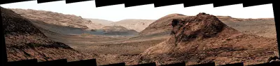
Los Burros #2 Trailhead, Apache Geology & Natural History
Beyond the trails and wildlife, Los Burros #2 sits within a landscape shaped by millions of years of geological processes. Here's what researchers and surveys have documented about this area.
Bedrock Geology
- Rock Type
- Pliocene to middle Miocene volcanic rocks
- Lithology
- Major:{rhyolite,dacite,andesite}
- Age
- Cenozoic
Mineral Deposits
- Deposit Sites
- 29
- Richness
- Moderate
- Minerals Found
- Volcanic Materials, Pumice, Sand and Gravel, Construction
Endangered Species
- Species at Risk
- 1478
- ESA Endangered
- 29
- ESA Threatened
- 16
- Conservation Score
- 100/100
Temperature Records
- Record High
- 91°F (2021-06-13)
- Record Low
- -40°F (1971-01-07)
Wildfire History
This area has a relatively low wildfire risk, but always follow posted fire regulations.
- Recorded Fires
- 44
- Largest Fire
- Turkey (9,002.8 acres)
- Most Recent
- 2024
- Fire Risk
- Extreme
Watershed
- Watershed
- Ord Creek
- Water Quality (Good)
- 0%
- Impaired
- 0%
Reported Phenomena
- UFO Sightings
- 3 (NUFORC)
- Bigfoot Reports
- 1 (BFRO)
- Eeriness Score
- 24/100
Los Burros #2 Trailhead, Apache Safety & Conditions
For up-to-the-minute safety information, use these official resources.
Don't rely on forecasts alone — check these live sources for the latest conditions near Los Burros #2.
Coordinates: 34.150903, -109.763258