Canyon Overlook Picnic Area (N, 0mi), Greenlee
Parks in Arizona
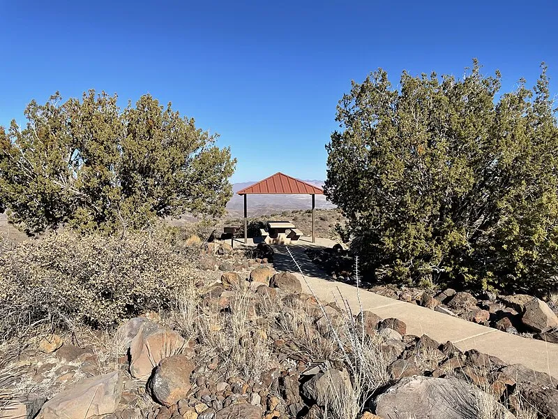
Photo: BLMArizona / Public domain
Near Morenci, AZ in Arizona
What to Pack for Canyon Overlook Picnic Area (N, 0mi), Greenlee
The right gear makes all the difference — here's a packing list tailored to this area.
Every item on this list exists because of specific conditions at Canyon Overlook Picnic Area — Desert terrain, Semi-Arid, and local wildlife.
Essential
-
Water (minimum 2L) — Water sources marked on maps may be seasonal or dry; carrying enough to complete your route prevents a dangerous shortfall.
-
Navigation (map/GPS/compass) — Getting lost is the leading cause of backcountry search-and-rescue calls; reliable navigation prevents the situation entirely.
-
Sun protection (sunglasses, sunscreen) — Prolonged sun exposure causes headaches, fatigue, and heat exhaustion that can cut a trip short or create a medical emergency.
-
First aid kit — Remote locations mean longer response times for help; a first aid kit bridges the gap between injury and professional care.
-
Extra food — High-energy snacks weigh little but provide crucial fuel if you need to bushwhack out or wait for conditions to improve.
-
Headlamp with extra batteries — Hands-free light is essential for navigating uneven terrain, setting up camp, or signaling for help at night.
-
Fire starter — Waterproof matches or a ferro rod weigh almost nothing and can be the difference between a cold night and a survivable one.
-
Emergency shelter (space blanket) — Wind and rain strip heat faster than most people realize; a compact emergency shelter blocks both.
-
Knife or multi-tool — A multi-tool handles problems you can't predict: jammed zippers, tangled line, first-aid tape cutting, or gear fixes on the trail.
-
Extra clothing layer — A lightweight fleece or puffy stuffs small but provides critical insulation if temperatures drop unexpectedly.
Wildlife Gear
-
Hiking buddy (avoid solo) — A companion can help with first aid, signaling, and decision-making if a wildlife encounter turns serious.
-
Noise maker — Group noise is especially important in dense brush or near berry patches where bears may be feeding and less alert.
-
Gaiters — Thick gaiters deflect fangs before they reach skin, buying critical time in areas with rattlesnakes or copperheads.
-
First-aid snakebite kit — Knowing how to immobilize a limb, mark swelling progression, and avoid harmful folk remedies can improve outcomes.
Terrain Gear
-
Wide-brim hat — At high elevation where UV is 10-12% stronger per 1,000 feet of gain, a hat provides constant passive protection.
-
Sunscreen SPF50+ — Sunburn isn't just discomfort — severe burns cause fluid loss, fatigue, and impaired thermoregulation that compound in remote settings.
-
Extra water (desert) — In arid heat, your body loses 1-2 liters per hour during exertion; running out of water in the desert is life-threatening.
-
SPF50 lip balm — High elevation, snow glare, and desert sun amplify UV exposure on exposed facial skin, especially lips.
Seasonal Gear
- Spring: Camera, Wildflower field guide
- Fall: Camera, Binoculars (foliage viewing)
- Winter: Microspikes/traction devices
Activities & Best Time to Visit Canyon Overlook Picnic Area (N, 0mi), Greenlee
The Desert terrain here lends itself to a range of outdoor activities throughout the year.
Outdoor recreation at Canyon Overlook Picnic Area centers on glamping, with the May, Jun, Jul, Aug, Sep months offering the best conditions.
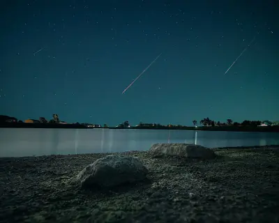
With a photography score of 65/100, Canyon Overlook Picnic Area offers Exceptional dark sky (Bortle 1-2) and 3 excellent meteor showers worth capturing.
Activities
-
glamping — Glamping blends outdoor immersion with convenience and style.
-
hiking — Hiking ranges from gentle nature walks to challenging summit climbs.
-
photography — Golden hour and dramatic weather can transform ordinary scenes into striking images.
-
picnicking — Picnicking turns a scenic overlook or shady grove into a memorable gathering spot.
-
rv_camping — RV camping blends outdoor living with modern amenities.
-
sightseeing — Sightseeing highlights iconic vistas, waterfalls, and unique rock formations.
-
walking — Walking lets you slow down and notice details — wildflowers, birdsong, shifting light through trees.
-
wildlife_viewing — Early mornings and dusk offer the best chances to quietly spot native wildlife.
Best months: May, Jun, Jul, Aug, Sep
Terrain: Desert — Cacti, shrubs, and drought-tolerant plants dominate arid landscapes.
Wildlife Safety at Canyon Overlook Picnic Area (N, 0mi), Greenlee
Most wildlife encounters are positive, but a few potential hazards are worth knowing about.
A danger score of 30/10 means Canyon Overlook Picnic Area requires moderate preparation compared to the average trail.
- Mountain lions
- Venomous snakes
- Remote (161mi from city)
- Exceptional dark sky (Bortle 1-2)
- 3 excellent meteor showers
- Fall foliage
- Spring wildflowers
Venomous Snakes
Watch your step — are present in the Desert habitat around Canyon Overlook Picnic Area.
- Watch where you step and place hands
- Stay on trails
- Wear boots and long pants in snake country
- Do not reach under rocks or logs
- If bitten: stay calm, immobilize limb, seek medical help immediately
- Do NOT: cut wound, suck venom, apply tourniquet, ice, or alcohol
Nature & Wildlife at Canyon Overlook Picnic Area (N, 0mi), Greenlee
The Desert terrain here supports a rich ecosystem worth noticing as you explore.
The plant life here ranges from Southwestern Ponderosa Pine and Emory oak in the canopy to California poppy along the trail edges.
Trees (4)
-
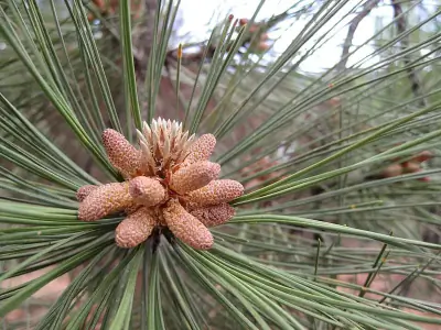 Southwestern Ponderosa Pine — Needles grow in bundles of three and cluster toward branch tips.
 -
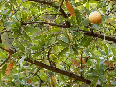 Emory oak — Acorns are large and mature in one season.
 -
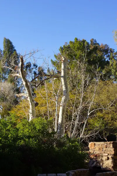 Arizona sycamore — Round seed balls hang on long stalks.
 -
 gray oak — Acorns mature in one season.
Wildflowers (1)
-
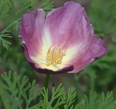 California poppy — Finely divided blue-green foliage forming low mounds.
Shrubs (2)
-
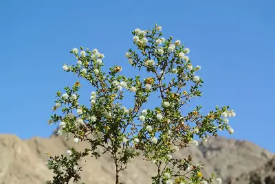 Creosote Bush — Bright yellow flowers bloom after rain.
 -
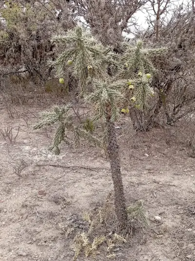 tree cholla — Older stems form a woody trunk-like base, giving it a branching tree form.
Other Plants (5)
-
alligator juniper
-
Parry's agave
-
ocotillo
-
pointleaf manzanita
-
fishhook barrel cactus
Mammals (3)
-
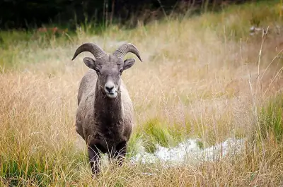 Bighorn Sheep — Rams carry massive curled horns.
 -
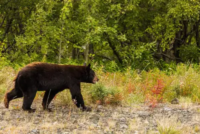 American Black Bear — Color varies from jet black to cinnamon or even blond.
 -
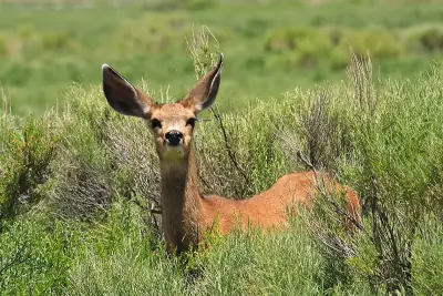 Mule Deer — Coat ranges from tawny brown in summer to gray-brown in winter.
Birds (30)
-
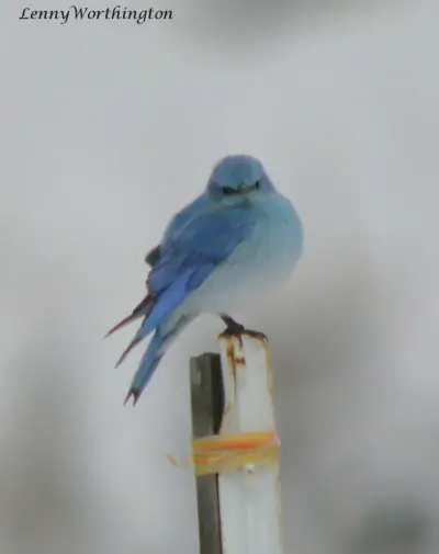 Mountain Bluebird — Paler female with gray tones
 -
 Bufflehead — Female with small cheek spot
 -
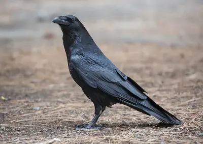 Common Raven — Broad wings with fingered primaries
 -
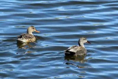 Gadwall — Mottled brown female
 -
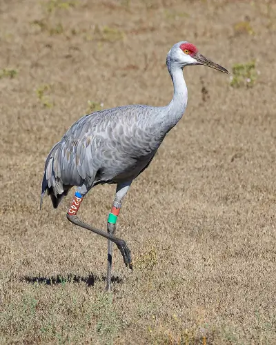 Sandhill Crane — Red crown patch
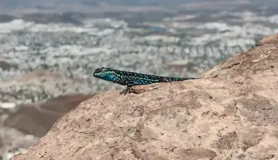
Reptiles (5)
-
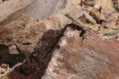 Greater Earless Lizard — Tan to brown with darker blotches and pale underside.
 -
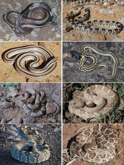 Western Black-tailed Rattlesnake — Distinct black coloration on last portion of tail before rattle.
 -
 Ornate Tree Lizard — Males may show bluish patches on the belly.
 -
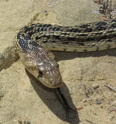 Gopher Snake — Head is slightly broader than the neck and often patterned with dark facial markings.
 -
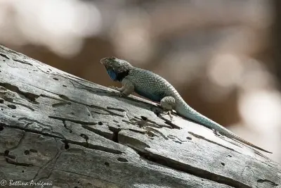 Clark's Spiny Lizard — Males may show blue markings on the throat and belly.
Amphibians (2)
-
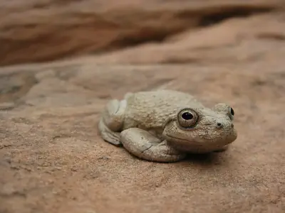 Canyon Tree Frog
 -
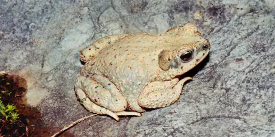 Red-spotted Toad
Insects (14)
-
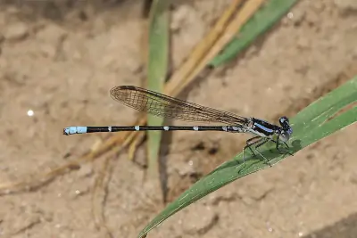 Blue-ringed Dancer
 -
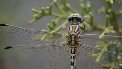 White-belted Ringtail
 -
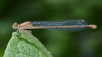 Powdered Dancer
 -
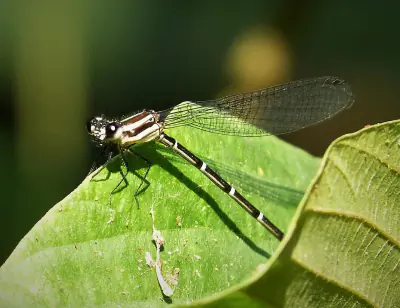 Dusky Dancer
 -
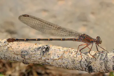 Sooty Dancer
Other Wildlife (2)
-
Arizona Bark Scorpion
-
Red Shiner
Nature Bingo at Canyon Overlook Picnic Area (N, 0mi), Greenlee
Can you spot them all? Check off each species as you find it on your visit.
Wildlife Challenge
Botany Challenge
Canyon Overlook Picnic Area (N, 0mi), Greenlee Climate & Sun
Month-by-month climate and daylight information for Canyon Overlook Picnic Area.
With 13.3 inches of annual precipitation and an average of 61.7°F, Canyon Overlook Picnic Area has Semi-Arid conditions.
Climate type: Semi-Arid
Annual avg temp: 61.7°F
Annual precipitation: 13.3 in
With an average annual temperature of 61.7°F and 13.3 inches of precipitation, Canyon Overlook Picnic Area has warm, dry conditions. Summer highs average around 80°F, while winter lows drop to 44°F.
Best months to visit: Mar, Apr, May, Sep, Oct, Nov.
| Month | Avg Temp | Precip |
|---|---|---|
| Jan | 44°F | 1.1 in |
| Feb | 47°F | 1.1 in |
| Mar | 53°F | 0.7 in |
| Apr | 60°F | 0.3 in |
| May | 68°F | 0.3 in |
| Jun | 79°F | 0.5 in |
| Jul | 80°F | 2.4 in |
| Aug | 78°F | 2.4 in |
| Sep | 73°F | 1.5 in |
| Oct | 64°F | 0.9 in |
| Nov | 53°F | 0.9 in |
| Dec | 44°F | 1.2 in |
Daylight & Sun Times
Daylight ranges from 10 hours in winter to 14.3 hours in summer — a difference of 4.3 hours.
Summer: 5:08 AM – 7:26 PM
Winter: 7:12 AM – 5:12 PM
Canyon Overlook Picnic Area (N, 0mi), Greenlee Trip Planning & Access
Ready to visit? Here's what to know about getting here and what it'll cost.
Trip planning for Canyon Overlook Picnic Area starts with the 161-mile route from Phoenix.
Visitor Friendliness
Visitor friendliness: families (excellent), dogs (likely_allowed), elderly (highly_suitable).
- Dogs: likely_allowed — No restrictions found
- Families: excellent
- Elderly: highly_suitable
- Strollers: excellent (100/100)
- Beginners: Perfect for beginners (Moderate difficulty (+5), Good information available (+5))
- Accessibility: Generally accessible to most visitors (90/100)
Places Near Canyon Overlook Picnic Area (N, 0mi), Greenlee
If you're in the area, these nearby destinations are worth considering too.
From campgrounds to trails to scenic attractions, 16 destinations surround Canyon Overlook Picnic Area.
Nearby Trails
- Pleasant Valley Trail, Greenlee 13.39 mi
- Hickey Springs Trail, Greenlee 13.86 mi
- Silver Trail, Greenlee 16.82 mi
- Brushy Trail, Greenlee 17.93 mi
- Woods Trail, Greenlee 18.73 mi
Nearby Campgrounds
- Owl Creek Campground, Greenlee 6.01 mi
- Riverview Campground, Graham 6.84 mi
- Black Jack Group Cg Campground, Greenlee 19.9 mi
- Granville Cg Campground, Greenlee 20.4 mi
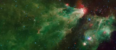
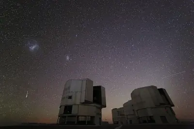
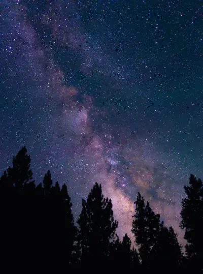
Stargazing & Night Sky at Canyon Overlook Picnic Area (N, 0mi), Greenlee
If you're staying past sunset, the stargazing conditions here are worth planning around.
For anyone who stays past sunset, the Bortle 2 conditions here reward patience with constellations and bright planets.
Constellations
Look for Ursa Minor, Cepheus — all visible from this location depending on the season.
-
 Ursa Minor — This compact constellation contains Polaris at the end of its handle, a reliable guide to true north.
 -
 Cepheus — Named for a mythological king, this constellation sits beside Cassiopeia and is circumpolar in northern latitudes.
Meteor Showers
For meteor viewing, the Geminids (December 13-14) offers the best show at this location.
-
 Geminids — peaks December 13-14 (excellent)
Cold December air often means clear skies—look overhead after midnight for bright, slow-moving meteors.
-
 Quadrantids — peaks January 3-4 (excellent)
Bundle up—January nights are frigid, but dark skies can produce bright fireballs.
-
 Perseids — peaks August 11-13 (excellent)
Peak activity typically builds after midnight when Perseus climbs higher.
-
 Eta Aquariids — peaks May 5-6 (good)
Southern U.S. observers often get better rates due to the radiant's position.
-
 Delta Aquariids — peaks July 28-29 (fair)
This steady shower rewards patient observers in dark, moonless conditions.
Planets
Planets visible to the naked eye from this location:
-
 Venus — The brightest planet, often called the Morning or Evening Star
 -
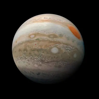 Jupiter — The largest planet, bright and steady in the night sky
 -
 Saturn — Famous for its rings, visible as a golden steady light
 -
 Mars — The Red Planet, recognizable by its reddish-orange hue
Equipment Guide
- Naked eye: Venus, Jupiter, Saturn, Mars, Mercury (with care)
- Binoculars: Jupiter moons, Uranus, Saturn rings (barely)
- Small telescope: Saturn rings, Jupiter bands, Mars surface features, Neptune
Viewing Tips
- Check planets rise/set times for your specific date
- Planets appear along the ecliptic (zodiac path)
- Planets don't twinkle like stars - steady light
- Venus and Jupiter are unmistakable - brightest objects after Moon
- Use a stargazing app to confirm planet positions
- Best viewing: when planet is highest in sky (transit)
Best Viewing Months
- Evening: Oct, Nov, Dec, Jan, Feb
- Morning: Jul, Aug, Sep
Seasonal Highlights at Canyon Overlook Picnic Area (N, 0mi), Greenlee
Each season brings something different to this area.
From wildflower blooms in spring to fall foliage in autumn, Canyon Overlook Picnic Area rewards visitors in every season.
Spring Wildflowers
Peak bloom: March - April
Check local park websites for bloom reports
Fall Foliage
Peak color: October 25 – November 15
Best trees for color: Maple, Oak, Aspen
Higher elevations peak 1-2 weeks earlier
Bird Migration
Spring peak: March - April
Fall peak: October - November
Best spots: Wetlands, coastlines, mountain ridges
Indigenous Land at Canyon Overlook Picnic Area (N, 0mi), Greenlee
Long before trails were marked and campgrounds built, this land was home to Indigenous peoples.
This area's history extends far beyond recreation — it is the traditional territory of Chiricahua Apache, Ndee/Nnēē: (Western Apache).
Territories
Languages
2 Indigenous languages are associated with the peoples of this area: White Mountain, Chiricahua.
Data from Native Land Digital
Canyon Overlook Picnic Area (N, 0mi), Greenlee Geology & Natural History
Beyond the trails and wildlife, Canyon Overlook Picnic Area sits within a landscape shaped by millions of years of geological processes. Here's what researchers and surveys have documented about this area.
Bedrock Geology
- Rock Type
- Pliocene to middle Miocene deposits
- Lithology
- Major:{conglomerate,sandstone}, Minor:{mudstone,siltstone,limestone,gypsum}
- Age
- Cenozoic
Fossils
- Fossil Occurrences
- 71
- Unique Species
- 64
- Oldest
- 372.2 million years ago
Mineral Deposits
- Deposit Sites
- 91
- Richness
- Exceptional
- Minerals Found
- Manganese, Fluorine-Fluorite, Sand and Gravel, Construction, Copper, Gold, Silver, Aluminum
Endangered Species
- Species at Risk
- 2513
- ESA Endangered
- 61
- ESA Threatened
- 31
- Conservation Score
- 100/100
Temperature Records
- Record High
- 113°F (2020-07-30)
- Record Low
- -3°F (2011-02-03)
Wildfire History
This area has a relatively low wildfire risk, but always follow posted fire regulations.
- Recorded Fires
- 12
- Largest Fire
- Ash Peak (241 acres)
- Most Recent
- 2024
- Fire Risk
- Extreme
Watershed
- Watershed
- Ash Peak Canyon-Gila River
- Water Quality (Good)
- 0%
- Impaired
- 7.371%
Reported Phenomena
- UFO Sightings
- 2 (NUFORC)
- Eeriness Score
- 4/100
Canyon Overlook Picnic Area (N, 0mi), Greenlee Safety & Conditions
Conditions change fast outdoors — bookmark these official sources for your visit.
The data above tells you what's typical — these links tell you what's happening at Canyon Overlook Picnic Area right now.
Coordinates: 32.892345, -109.362227